You are here: Home > Network List > AZ - ANZA Regional Network Stations List
> Station SMER AZ.SMER > Earthquake Result Viewer
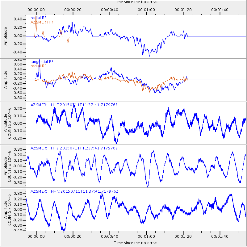
SMER AZ.SMER - Earthquake Result Viewer
*The percent match for this event was below the threshold and hence no stack was calculated.
| Earthquake location: |
East Of Kuril Islands |
| Earthquake latitude/longitude: |
43.9/148.0 |
| Earthquake time(UTC): |
2015/07/11 (192) 11:26:59 GMT |
| Earthquake Depth: |
32 km |
| Earthquake Magnitude: |
5.5 MB |
| Earthquake Catalog/Contributor: |
NEIC PDE/NEIC COMCAT |
|
| Network: |
AZ ANZA Regional Network |
| Station: |
SMER AZ.SMER |
| Lat/Lon: |
33.46 N/117.17 W |
| Elevation: |
355 m |
|
| Distance: |
70.8 deg |
| Az: |
61.887 deg |
| Baz: |
310.3 deg |
| Ray Param: |
$rayparam |
*The percent match for this event was below the threshold and hence was not used in the summary stack. |
|
| Radial Match: |
55.051105 % |
| Radial Bump: |
400 |
| Transverse Match: |
52.56669 % |
| Transverse Bump: |
400 |
| SOD ConfigId: |
1085051 |
| Insert Time: |
2015-07-25 11:48:00.616 +0000 |
| GWidth: |
2.5 |
| Max Bumps: |
400 |
| Tol: |
0.001 |
|
Signal To Noise
| Channel | StoN | STA | LTA |
| AZ:SMER: :HHZ:20150711T11:37:41.717976Z | 1.126162 | 9.010382E-8 | 8.0009634E-8 |
| AZ:SMER: :HHN:20150711T11:37:41.717976Z | 1.3249812 | 1.8505399E-7 | 1.3966537E-7 |
| AZ:SMER: :HHE:20150711T11:37:41.717976Z | 0.6410491 | 4.883472E-8 | 7.617938E-8 |
| Arrivals |
| Ps | |
| PpPs | |
| PsPs/PpSs | |


