You are here: Home > Network List > TA - USArray Transportable Network (new EarthScope stations) Stations List
> Station TUL1 Leonard, OK, USA > Earthquake Result Viewer
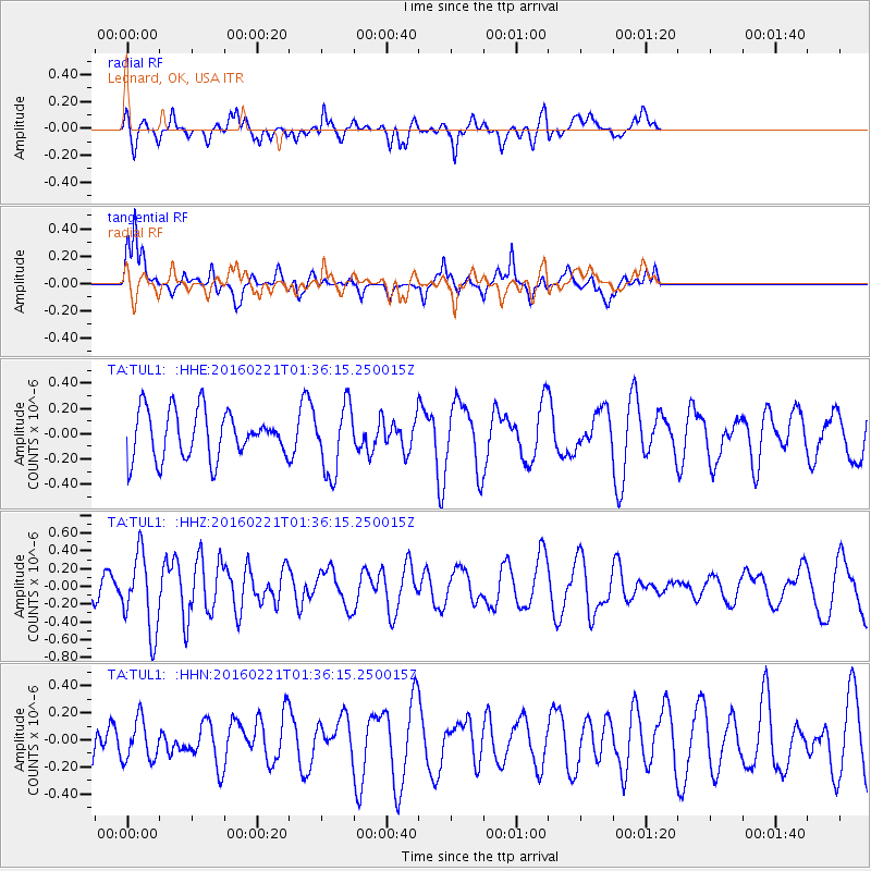
TUL1 Leonard, OK, USA - Earthquake Result Viewer
*The percent match for this event was below the threshold and hence no stack was calculated.
| Earthquake location: |
Central Mid-Atlantic Ridge |
| Earthquake latitude/longitude: |
4.7/-32.6 |
| Earthquake time(UTC): |
2016/02/21 (052) 01:26:02 GMT |
| Earthquake Depth: |
10 km |
| Earthquake Magnitude: |
5.3 mb |
| Earthquake Catalog/Contributor: |
NEIC PDE/us |
|
| Network: |
TA USArray Transportable Network (new EarthScope stations) |
| Station: |
TUL1 Leonard, OK, USA |
| Lat/Lon: |
35.91 N/95.79 W |
| Elevation: |
256 m |
|
| Distance: |
65.6 deg |
| Az: |
307.309 deg |
| Baz: |
102.446 deg |
| Ray Param: |
$rayparam |
*The percent match for this event was below the threshold and hence was not used in the summary stack. |
|
| Radial Match: |
40.963696 % |
| Radial Bump: |
337 |
| Transverse Match: |
59.74827 % |
| Transverse Bump: |
347 |
| SOD ConfigId: |
7422571 |
| Insert Time: |
2019-04-21 23:08:19.994 +0000 |
| GWidth: |
2.5 |
| Max Bumps: |
400 |
| Tol: |
0.001 |
|
Signal To Noise
| Channel | StoN | STA | LTA |
| TA:TUL1: :HHZ:20160221T01:36:15.250015Z | 1.8475708 | 4.3610683E-7 | 2.3604336E-7 |
| TA:TUL1: :HHN:20160221T01:36:15.250015Z | 0.8041285 | 1.5057263E-7 | 1.8724947E-7 |
| TA:TUL1: :HHE:20160221T01:36:15.250015Z | 1.4429127 | 2.6818068E-7 | 1.8586063E-7 |
| Arrivals |
| Ps | |
| PpPs | |
| PsPs/PpSs | |


