WMQ Urumqi, Xinjiang Province, China - Earthquake Result Viewer
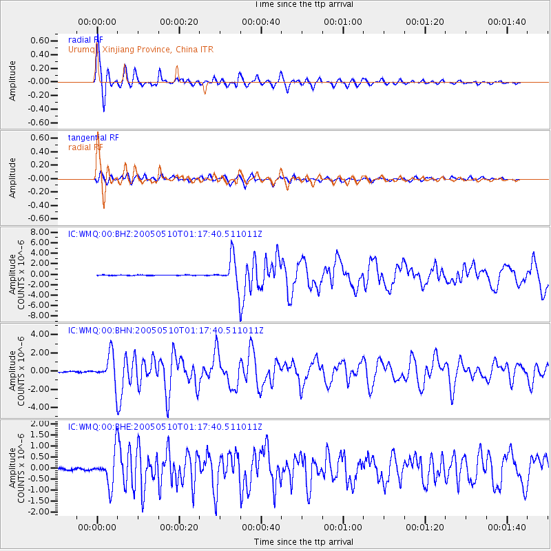
Earthquake location: Southwest Of Sumatra, Indonesia
Earthquake latitude/longitude: -6.2/103.1
Earthquake time(UTC): 2005/05/10 (130) 01:09:05 GMT
Earthquake Depth: 17 km
Earthquake Magnitude: 5.9 MB, 6.4 MS, 6.2 MW, 6.2 MW
Earthquake Catalog/Contributor: WHDF/NEIC
Network: IC New China Digital Seismograph Network
Station: WMQ Urumqi, Xinjiang Province, China
Lat/Lon: 43.82 N/87.69 E
Elevation: 903 m
Distance: 51.7 deg
Az: 345.789 deg
Baz: 160.294 deg
Ray Param: 0.06720101
Estimated Moho Depth: 22.5 km
Estimated Crust Vp/Vs: 1.68
Assumed Crust Vp: 6.242 km/s
Estimated Crust Vs: 3.721 km/s
Estimated Crust Poisson's Ratio: 0.22
Radial Match: 96.53405 %
Radial Bump: 379
Transverse Match: 82.40313 %
Transverse Bump: 400
SOD ConfigId: 2455
Insert Time: 2010-03-05 00:09:45.492 +0000
GWidth: 2.5
Max Bumps: 400
Tol: 0.001

Signal To Noise

ChannelStoNSTALTA
IC:WMQ:00:BHN:20050510T01:17:40.511011Z40.1258161.648402E-64.1080835E-8
IC:WMQ:00:BHE:20050510T01:17:40.511011Z21.1218627.6533473E-73.6234244E-8
IC:WMQ:00:BHZ:20050510T01:17:40.511011Z59.5654752.8224238E-64.738355E-8
Arrivals
Ps2.6 SECOND
PpPs9.1 SECOND
PsPs/PpSs12 SECOND