WMQ Urumqi, Xinjiang Province, China - Earthquake Result Viewer
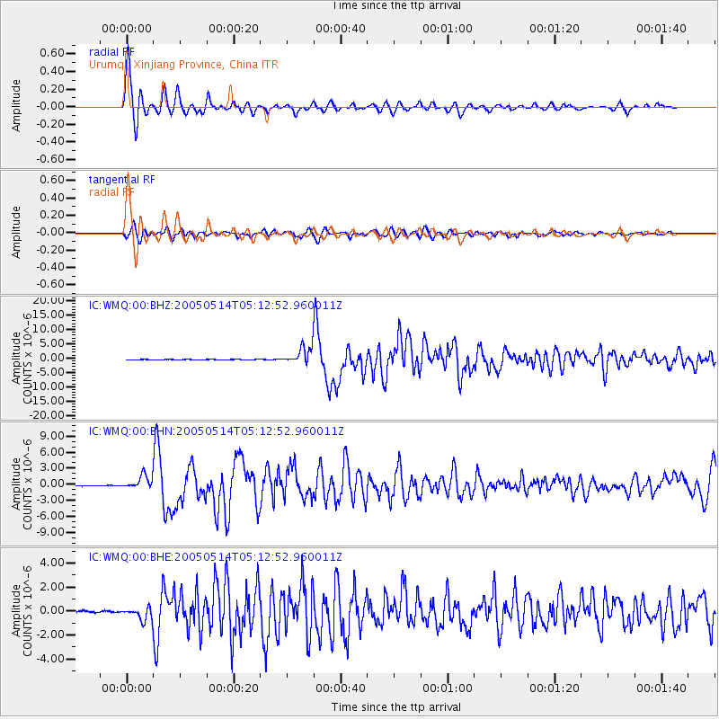
Earthquake location: Northern Sumatra, Indonesia
Earthquake latitude/longitude: 0.6/98.5
Earthquake time(UTC): 2005/05/14 (134) 05:05:18 GMT
Earthquake Depth: 34 km
Earthquake Magnitude: 6.4 MB, 6.8 MS, 6.8 MW, 6.8 MW
Earthquake Catalog/Contributor: WHDF/NEIC
Network: IC New China Digital Seismograph Network
Station: WMQ Urumqi, Xinjiang Province, China
Lat/Lon: 43.82 N/87.69 E
Elevation: 903 m
Distance: 44.1 deg
Az: 348.8 deg
Baz: 164.435 deg
Ray Param: 0.072054826
Estimated Moho Depth: 61.75 km
Estimated Crust Vp/Vs: 1.66
Assumed Crust Vp: 6.242 km/s
Estimated Crust Vs: 3.749 km/s
Estimated Crust Poisson's Ratio: 0.22
Radial Match: 94.631256 %
Radial Bump: 377
Transverse Match: 79.59856 %
Transverse Bump: 400
SOD ConfigId: 2455
Insert Time: 2010-03-05 00:09:47.486 +0000
GWidth: 2.5
Max Bumps: 400
Tol: 0.001

Signal To Noise

ChannelStoNSTALTA
IC:WMQ:00:BHN:20050514T05:12:52.960011Z29.3983941.252202E-64.259423E-8
IC:WMQ:00:BHE:20050514T05:12:52.960011Z8.7803265.132537E-75.8454972E-8
IC:WMQ:00:BHZ:20050514T05:12:52.960011Z39.40322.9217647E-67.415045E-8
Arrivals
Ps7.0 SECOND
PpPs25 SECOND
PsPs/PpSs32 SECOND