You are here: Home > Network List > TA - USArray Transportable Network (new EarthScope stations) Stations List
> Station J20K Nowitna River, AK, USA > Earthquake Result Viewer
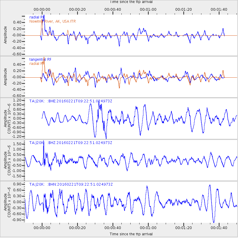
J20K Nowitna River, AK, USA - Earthquake Result Viewer
*The percent match for this event was below the threshold and hence no stack was calculated.
| Earthquake location: |
Hindu Kush Region, Afghanistan |
| Earthquake latitude/longitude: |
36.5/70.9 |
| Earthquake time(UTC): |
2016/02/21 (052) 09:12:08 GMT |
| Earthquake Depth: |
177 km |
| Earthquake Magnitude: |
5.5 MB |
| Earthquake Catalog/Contributor: |
NEIC PDE/NEIC COMCAT |
|
| Network: |
TA USArray Transportable Network (new EarthScope stations) |
| Station: |
J20K Nowitna River, AK, USA |
| Lat/Lon: |
64.18 N/154.15 W |
| Elevation: |
314 m |
|
| Distance: |
73.6 deg |
| Az: |
18.837 deg |
| Baz: |
323.543 deg |
| Ray Param: |
$rayparam |
*The percent match for this event was below the threshold and hence was not used in the summary stack. |
|
| Radial Match: |
61.4311 % |
| Radial Bump: |
400 |
| Transverse Match: |
62.41806 % |
| Transverse Bump: |
400 |
| SOD ConfigId: |
7422571 |
| Insert Time: |
2019-04-21 23:14:08.801 +0000 |
| GWidth: |
2.5 |
| Max Bumps: |
400 |
| Tol: |
0.001 |
|
Signal To Noise
| Channel | StoN | STA | LTA |
| TA:J20K: :BHZ:20160221T09:22:51.024973Z | 1.4863259 | 5.324539E-7 | 3.5823496E-7 |
| TA:J20K: :BHN:20160221T09:22:51.024973Z | 0.6843532 | 2.6901913E-7 | 3.9309984E-7 |
| TA:J20K: :BHE:20160221T09:22:51.024973Z | 3.609 | 7.404691E-7 | 2.0517292E-7 |
| Arrivals |
| Ps | |
| PpPs | |
| PsPs/PpSs | |


