WMQ Urumqi, Xinjiang Province, China - Earthquake Result Viewer
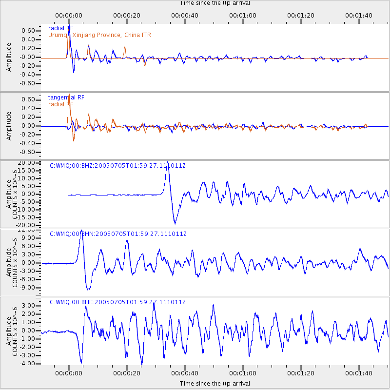
Earthquake location: Northern Sumatra, Indonesia
Earthquake latitude/longitude: 1.8/97.1
Earthquake time(UTC): 2005/07/05 (186) 01:52:02 GMT
Earthquake Depth: 21 km
Earthquake Magnitude: 6.2 MB, 6.8 MS, 6.7 MW, 6.6 MW
Earthquake Catalog/Contributor: WHDF/NEIC
Network: IC New China Digital Seismograph Network
Station: WMQ Urumqi, Xinjiang Province, China
Lat/Lon: 43.82 N/87.69 E
Elevation: 903 m
Distance: 42.6 deg
Az: 349.965 deg
Baz: 166.077 deg
Ray Param: 0.073023535
Estimated Moho Depth: 23.25 km
Estimated Crust Vp/Vs: 1.66
Assumed Crust Vp: 6.242 km/s
Estimated Crust Vs: 3.749 km/s
Estimated Crust Poisson's Ratio: 0.22
Radial Match: 95.51082 %
Radial Bump: 400
Transverse Match: 90.07912 %
Transverse Bump: 400
SOD ConfigId: 2475
Insert Time: 2010-03-05 00:10:06.291 +0000
GWidth: 2.5
Max Bumps: 400
Tol: 0.001

Signal To Noise

ChannelStoNSTALTA
IC:WMQ:00:BHN:20050705T01:59:27.111011Z74.784385.2049268E-66.959912E-8
IC:WMQ:00:BHE:20050705T01:59:27.111011Z18.7824481.5245531E-68.1169034E-8
IC:WMQ:00:BHZ:20050705T01:59:27.111011Z85.832838.866444E-61.0329897E-7
Arrivals
Ps2.6 SECOND
PpPs9.3 SECOND
PsPs/PpSs12 SECOND