
WMQ Urumqi, Xinjiang Province, China - Earthquake Result Viewer
| ||||||||||||||||||
| ||||||||||||||||||
| ||||||||||||||||||
|
Signal To Noise
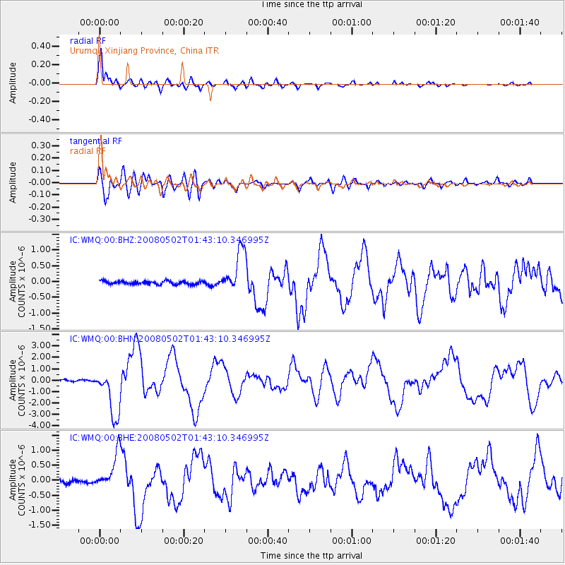
| Channel | StoN | STA | LTA |
| IC:WMQ:00:BHN:20080502T01:43:10.346995Z | 31.257534 | 2.1880776E-6 | 7.0001605E-8 |
| IC:WMQ:00:BHE:20080502T01:43:10.346995Z | 9.851603 | 6.226795E-7 | 6.320591E-8 |
| IC:WMQ:00:BHZ:20080502T01:43:10.346995Z | 13.645881 | 7.0507105E-7 | 5.166915E-8 |
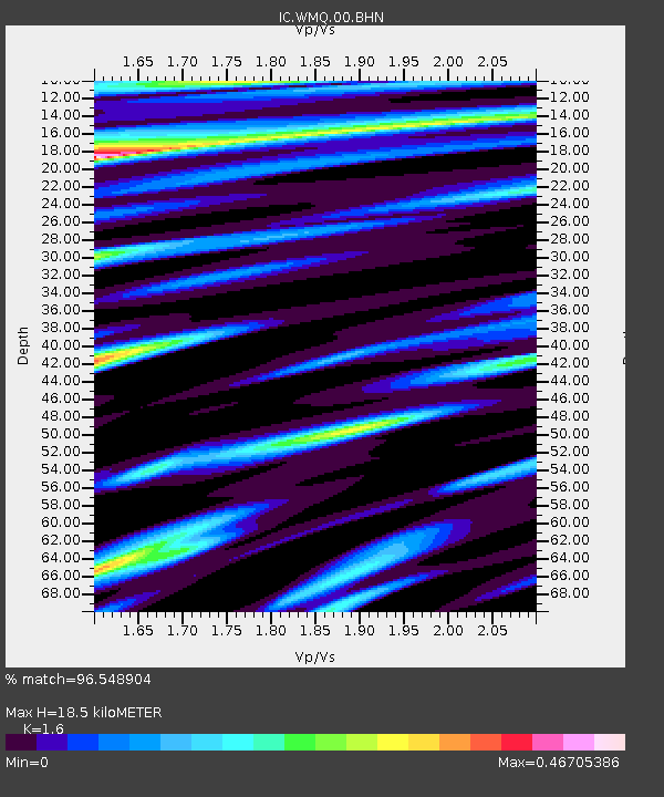
| Arrivals | |
| Ps | 1.9 SECOND |
| PpPs | 7.3 SECOND |
| PsPs/PpSs | 9.2 SECOND |

