
WMQ Urumqi, Xinjiang Province, China - Earthquake Result Viewer
| ||||||||||||||||||
| ||||||||||||||||||
| ||||||||||||||||||
|
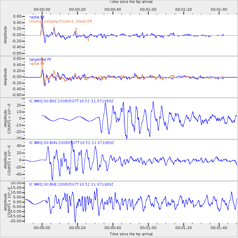
Signal To Noise
| Channel | StoN | STA | LTA |
| IC:WMQ:00:BHN:20080507T16:52:31.671989Z | 7.6861653 | 1.520544E-5 | 1.978287E-6 |
| IC:WMQ:00:BHE:20080507T16:52:31.671989Z | 1.4616137 | 3.4032366E-6 | 2.3284106E-6 |
| IC:WMQ:00:BHZ:20080507T16:52:31.671989Z | 3.8930676 | 8.376938E-6 | 2.1517576E-6 |
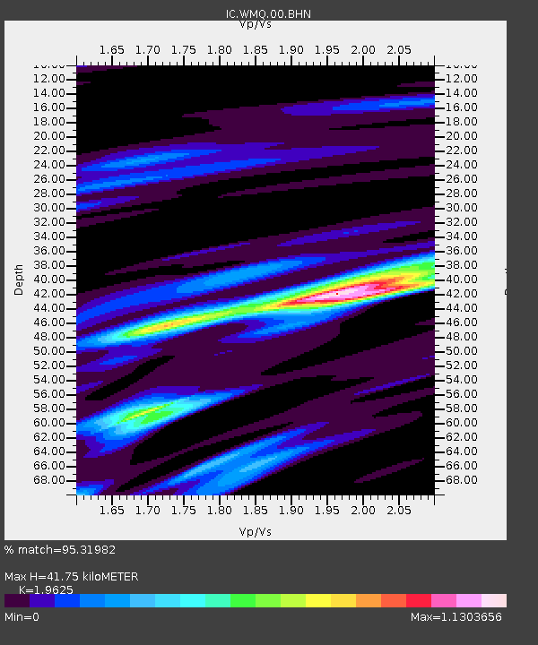
| Arrivals | |
| Ps | 6.8 SECOND |
| PpPs | 19 SECOND |
| PsPs/PpSs | 26 SECOND |

