You are here: Home > Network List > AZ - ANZA Regional Network Stations List
> Station SMER AZ.SMER > Earthquake Result Viewer
SMER AZ.SMER - Earthquake Result Viewer
*The percent match for this event was below the threshold and hence no stack was calculated.
| Earthquake location: |
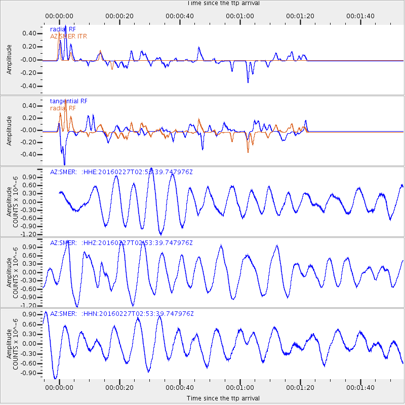
Central Mid-Atlantic Ridge |
| Earthquake latitude/longitude: |
4.5/-32.7 |
| Earthquake time(UTC): |
2016/02/27 (058) 02:41:46 GMT |
| Earthquake Depth: |
10 km |
| Earthquake Magnitude: |
5.5 MB |
| Earthquake Catalog/Contributor: |
NEIC PDE/NEIC COMCAT |
|
| Network: |
AZ ANZA Regional Network |
| Station: |
SMER AZ.SMER |
| Lat/Lon: |
33.46 N/117.17 W |
| Elevation: |
355 m |
|
| Distance: |
83.0 deg |
| Az: |
303.023 deg |
| Baz: |
89.277 deg |
| Ray Param: |
$rayparam |
*The percent match for this event was below the threshold and hence was not used in the summary stack. |
|
| Radial Match: |
57.995113 % |
| Radial Bump: |
400 |
| Transverse Match: |
66.3492 % |
| Transverse Bump: |
400 |
| SOD ConfigId: |
7422571 |
| Insert Time: |
2019-04-21 23:34:23.106 +0000 |
| GWidth: |
2.5 |
| Max Bumps: |
400 |
| Tol: |
0.001 |
|
Signal To Noise
| Channel | StoN | STA | LTA |
| AZ:SMER: :HHZ:20160227T02:53:39.747976Z | 0.9077649 | 6.356157E-7 | 7.001986E-7 |
| AZ:SMER: :HHN:20160227T02:53:39.747976Z | 0.94643265 | 4.7837193E-7 | 5.054474E-7 |
| AZ:SMER: :HHE:20160227T02:53:39.747976Z | 1.9052628 | 8.965082E-7 | 4.7054306E-7 |
| Arrivals |
| Ps | |
| PpPs | |
| PsPs/PpSs | |


