You are here: Home > Network List > CI - Caltech Regional Seismic Network Stations List
> Station SWS Sam W. Stewart, Westmorland, CA, USA > Earthquake Result Viewer
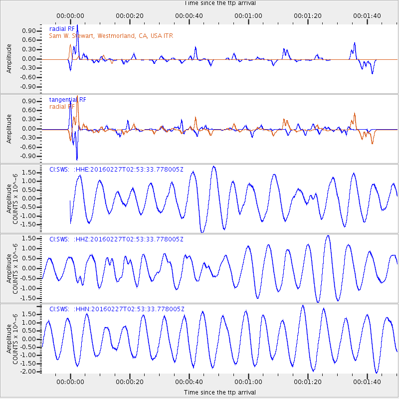
SWS Sam W. Stewart, Westmorland, CA, USA - Earthquake Result Viewer
*The percent match for this event was below the threshold and hence no stack was calculated.
| Earthquake location: |
Central Mid-Atlantic Ridge |
| Earthquake latitude/longitude: |
4.5/-32.7 |
| Earthquake time(UTC): |
2016/02/27 (058) 02:41:46 GMT |
| Earthquake Depth: |
10 km |
| Earthquake Magnitude: |
5.5 MB |
| Earthquake Catalog/Contributor: |
NEIC PDE/NEIC COMCAT |
|
| Network: |
CI Caltech Regional Seismic Network |
| Station: |
SWS Sam W. Stewart, Westmorland, CA, USA |
| Lat/Lon: |
32.94 N/115.80 W |
| Elevation: |
140 m |
|
| Distance: |
81.8 deg |
| Az: |
302.495 deg |
| Baz: |
89.956 deg |
| Ray Param: |
$rayparam |
*The percent match for this event was below the threshold and hence was not used in the summary stack. |
|
| Radial Match: |
80.34357 % |
| Radial Bump: |
323 |
| Transverse Match: |
81.21427 % |
| Transverse Bump: |
324 |
| SOD ConfigId: |
7422571 |
| Insert Time: |
2019-04-21 23:35:21.462 +0000 |
| GWidth: |
2.5 |
| Max Bumps: |
400 |
| Tol: |
0.001 |
|
Signal To Noise
| Channel | StoN | STA | LTA |
| CI:SWS: :HHZ:20160227T02:53:33.778005Z | 1.0683036 | 5.335233E-7 | 4.9941167E-7 |
| CI:SWS: :HHN:20160227T02:53:33.778005Z | 1.5190853 | 1.049524E-6 | 6.908921E-7 |
| CI:SWS: :HHE:20160227T02:53:33.778005Z | 0.84925246 | 6.066932E-7 | 7.1438495E-7 |
| Arrivals |
| Ps | |
| PpPs | |
| PsPs/PpSs | |


