You are here: Home > Network List > TA - USArray Transportable Network (new EarthScope stations) Stations List
> Station M31M Drury Creek, Yukon, CA > Earthquake Result Viewer
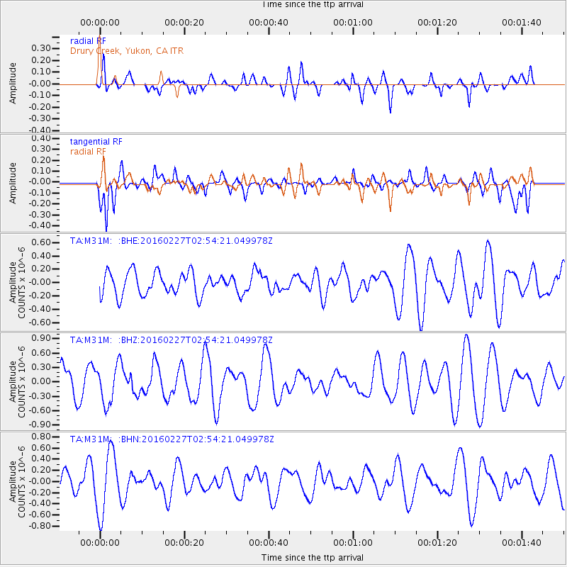
M31M Drury Creek, Yukon, CA - Earthquake Result Viewer
*The percent match for this event was below the threshold and hence no stack was calculated.
| Earthquake location: |
Central Mid-Atlantic Ridge |
| Earthquake latitude/longitude: |
4.5/-32.7 |
| Earthquake time(UTC): |
2016/02/27 (058) 02:41:46 GMT |
| Earthquake Depth: |
10 km |
| Earthquake Magnitude: |
5.5 MB |
| Earthquake Catalog/Contributor: |
NEIC PDE/NEIC COMCAT |
|
| Network: |
TA USArray Transportable Network (new EarthScope stations) |
| Station: |
M31M Drury Creek, Yukon, CA |
| Lat/Lon: |
62.20 N/134.39 W |
| Elevation: |
639 m |
|
| Distance: |
91.5 deg |
| Az: |
332.666 deg |
| Baz: |
77.559 deg |
| Ray Param: |
$rayparam |
*The percent match for this event was below the threshold and hence was not used in the summary stack. |
|
| Radial Match: |
56.065655 % |
| Radial Bump: |
400 |
| Transverse Match: |
66.95154 % |
| Transverse Bump: |
400 |
| SOD ConfigId: |
7422571 |
| Insert Time: |
2019-04-21 23:40:17.445 +0000 |
| GWidth: |
2.5 |
| Max Bumps: |
400 |
| Tol: |
0.001 |
|
Signal To Noise
| Channel | StoN | STA | LTA |
| TA:M31M: :BHZ:20160227T02:54:21.049978Z | 0.8352688 | 4.121092E-7 | 4.9338513E-7 |
| TA:M31M: :BHN:20160227T02:54:21.049978Z | 2.0949397 | 5.634472E-7 | 2.689563E-7 |
| TA:M31M: :BHE:20160227T02:54:21.049978Z | 0.67829436 | 1.221788E-7 | 1.8012652E-7 |
| Arrivals |
| Ps | |
| PpPs | |
| PsPs/PpSs | |


