You are here: Home > Network List > US - United States National Seismic Network Stations List
> Station DGMT Dagmar, Montana, USA > Earthquake Result Viewer
DGMT Dagmar, Montana, USA - Earthquake Result Viewer
*The percent match for this event was below the threshold and hence no stack was calculated.
| Earthquake location: |
Central Mid-Atlantic Ridge |
| Earthquake latitude/longitude: |
4.5/-32.7 |
| Earthquake time(UTC): |
2016/02/27 (058) 02:41:46 GMT |
| Earthquake Depth: |
10 km |
| Earthquake Magnitude: |
5.5 MB |
| Earthquake Catalog/Contributor: |
NEIC PDE/NEIC COMCAT |
|
| Network: |
US United States National Seismic Network |
| Station: |
DGMT Dagmar, Montana, USA |
| Lat/Lon: |
48.47 N/104.20 W |
| Elevation: |
0.0 m |
|
| Distance: |
74.4 deg |
| Az: |
319.064 deg |
| Baz: |
101.016 deg |
| Ray Param: |
$rayparam |
*The percent match for this event was below the threshold and hence was not used in the summary stack. |
|
| Radial Match: |
63.02411 % |
| Radial Bump: |
400 |
| Transverse Match: |
51.566505 % |
| Transverse Bump: |
354 |
| SOD ConfigId: |
7422571 |
| Insert Time: |
2019-04-21 23:40:41.264 +0000 |
| GWidth: |
2.5 |
| Max Bumps: |
400 |
| Tol: |
0.001 |
|
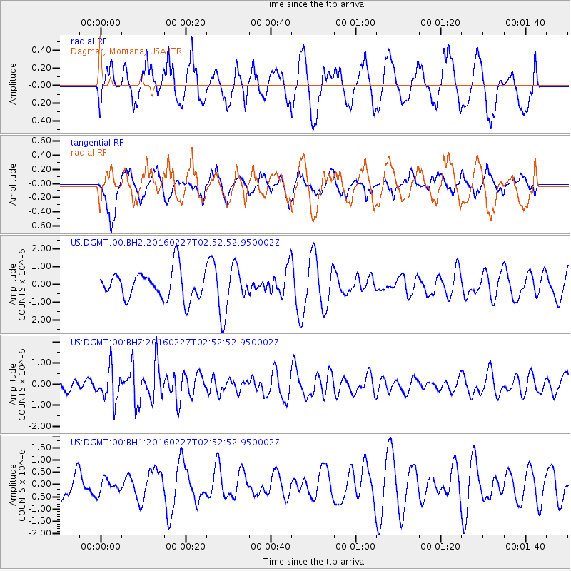
Signal To Noise
| Channel | StoN | STA | LTA |
| US:DGMT:00:BHZ:20160227T02:52:52.950002Z | 5.265038 | 7.580763E-7 | 1.4398306E-7 |
| US:DGMT:00:BH1:20160227T02:52:52.950002Z | 0.4328188 | 2.7904932E-7 | 6.4472545E-7 |
| US:DGMT:00:BH2:20160227T02:52:52.950002Z | 1.3889161 | 1.1106339E-6 | 7.996407E-7 |
| Arrivals |
| Ps | |
| PpPs | |
| PsPs/PpSs | |


