WMQ Urumqi, Xinjiang Province, China - Earthquake Result Viewer
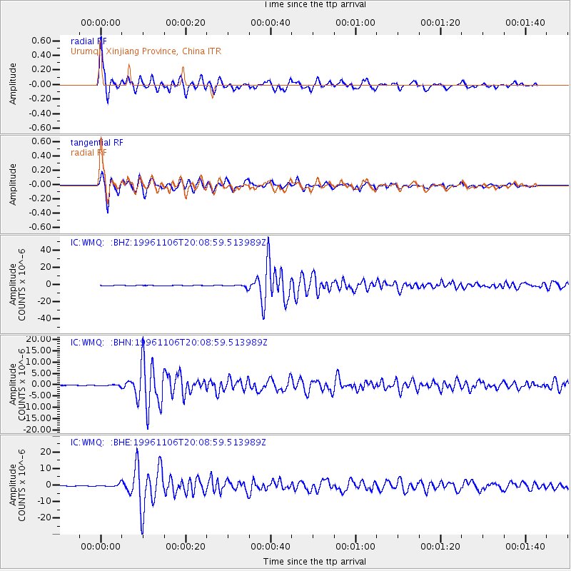
Earthquake location: Bonin Islands, Japan Region
Earthquake latitude/longitude: 28.0/143.5
Earthquake time(UTC): 1996/11/06 (311) 20:00:58 GMT
Earthquake Depth: 9.0 km
Earthquake Magnitude: 6.4 MB, 6.5 MS, 6.6 UNKNOWN, 6.4 ME
Earthquake Catalog/Contributor: WHDF/NEIC
Network: IC New China Digital Seismograph Network
Station: WMQ Urumqi, Xinjiang Province, China
Lat/Lon: 43.82 N/87.69 E
Elevation: 903 m
Distance: 47.0 deg
Az: 305.06 deg
Baz: 90.355 deg
Ray Param: 0.07026274
Estimated Moho Depth: 43.0 km
Estimated Crust Vp/Vs: 1.86
Assumed Crust Vp: 6.242 km/s
Estimated Crust Vs: 3.356 km/s
Estimated Crust Poisson's Ratio: 0.30
Radial Match: 94.75389 %
Radial Bump: 400
Transverse Match: 92.025925 %
Transverse Bump: 400
SOD ConfigId: 6273
Insert Time: 2010-03-05 00:12:55.568 +0000
GWidth: 2.5
Max Bumps: 400
Tol: 0.001

Signal To Noise

ChannelStoNSTALTA
IC:WMQ: :BHN:19961106T20:08:59.513989Z1.09910542.9229335E-72.659375E-7
IC:WMQ: :BHE:19961106T20:08:59.513989Z5.22025259.4052376E-71.8016824E-7
IC:WMQ: :BHZ:19961106T20:08:59.513989Z13.8110121.8680506E-61.3525805E-7
Arrivals
Ps6.3 SECOND
PpPs19 SECOND
PsPs/PpSs25 SECOND