You are here: Home > Network List > TA - USArray Transportable Network (new EarthScope stations) Stations List
> Station 121A Cookes Peak, Deming, NM, USA > Earthquake Result Viewer
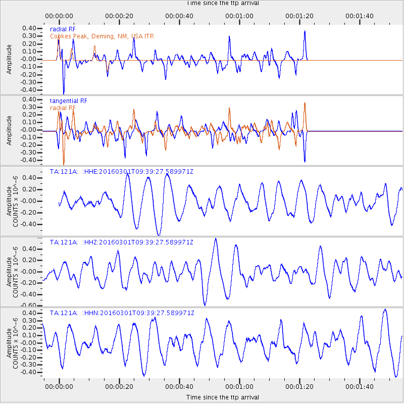
121A Cookes Peak, Deming, NM, USA - Earthquake Result Viewer
*The percent match for this event was below the threshold and hence no stack was calculated.
| Earthquake location: |
South Of Kermadec Islands |
| Earthquake latitude/longitude: |
-32.9/-178.4 |
| Earthquake time(UTC): |
2016/03/01 (061) 09:26:45 GMT |
| Earthquake Depth: |
10 km |
| Earthquake Magnitude: |
5.6 MWW, 5.5 MWB, 5.7 MWC |
| Earthquake Catalog/Contributor: |
NEIC PDE/NEIC COMCAT |
|
| Network: |
TA USArray Transportable Network (new EarthScope stations) |
| Station: |
121A Cookes Peak, Deming, NM, USA |
| Lat/Lon: |
32.53 N/107.79 W |
| Elevation: |
1652 m |
|
| Distance: |
93.1 deg |
| Az: |
52.931 deg |
| Baz: |
232.592 deg |
| Ray Param: |
$rayparam |
*The percent match for this event was below the threshold and hence was not used in the summary stack. |
|
| Radial Match: |
75.29286 % |
| Radial Bump: |
400 |
| Transverse Match: |
68.04363 % |
| Transverse Bump: |
395 |
| SOD ConfigId: |
7422571 |
| Insert Time: |
2019-04-21 23:52:17.657 +0000 |
| GWidth: |
2.5 |
| Max Bumps: |
400 |
| Tol: |
0.001 |
|
Signal To Noise
| Channel | StoN | STA | LTA |
| TA:121A: :HHZ:20160301T09:39:27.589971Z | 0.5879888 | 1.1235403E-7 | 1.9108194E-7 |
| TA:121A: :HHN:20160301T09:39:27.589971Z | 1.1776251 | 1.9726036E-7 | 1.6750694E-7 |
| TA:121A: :HHE:20160301T09:39:27.589971Z | 2.678645 | 3.8457668E-7 | 1.4357136E-7 |
| Arrivals |
| Ps | |
| PpPs | |
| PsPs/PpSs | |


