You are here: Home > Network List > IU - Global Seismograph Network (GSN - IRIS/USGS) Stations List
> Station PMG Port Moresby, New Guinea > Earthquake Result Viewer
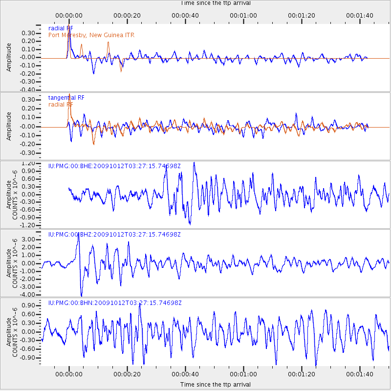
PMG Port Moresby, New Guinea - Earthquake Result Viewer
*The percent match for this event was below the threshold and hence no stack was calculated.
| Earthquake location: |
Mauritius - Reunion Region |
| Earthquake latitude/longitude: |
-17.1/66.7 |
| Earthquake time(UTC): |
2009/10/12 (285) 03:15:47 GMT |
| Earthquake Depth: |
10 km |
| Earthquake Magnitude: |
6.2 MB, 6.0 MS, 6.2 MW, 6.1 MW |
| Earthquake Catalog/Contributor: |
WHDF/NEIC |
|
| Network: |
IU Global Seismograph Network (GSN - IRIS/USGS) |
| Station: |
PMG Port Moresby, New Guinea |
| Lat/Lon: |
9.40 S/147.16 E |
| Elevation: |
90 m |
|
| Distance: |
78.2 deg |
| Az: |
96.305 deg |
| Baz: |
254.439 deg |
| Ray Param: |
$rayparam |
*The percent match for this event was below the threshold and hence was not used in the summary stack. |
|
| Radial Match: |
76.815674 % |
| Radial Bump: |
400 |
| Transverse Match: |
78.133575 % |
| Transverse Bump: |
400 |
| SOD ConfigId: |
1 |
| Insert Time: |
2010-02-19 00:42:43.343 +0000 |
| GWidth: |
2.5 |
| Max Bumps: |
400 |
| Tol: |
0.001 |
|
Signal To Noise
| Channel | StoN | STA | LTA |
| IU:PMG:00:BHZ:20091012T03:27:15.74698Z | 7.8376827 | 1.9488334E-6 | 2.486492E-7 |
| IU:PMG:00:BHN:20091012T03:27:15.74698Z | 1.3496612 | 2.966837E-7 | 2.1982089E-7 |
| IU:PMG:00:BHE:20091012T03:27:15.74698Z | 2.5368328 | 4.5060372E-7 | 1.7762451E-7 |
| Arrivals |
| Ps | |
| PpPs | |
| PsPs/PpSs | |


