You are here: Home > Network List > KN - Kyrgyz Seismic Telemetry Network Stations List
> Station TKM2 - > Earthquake Result Viewer
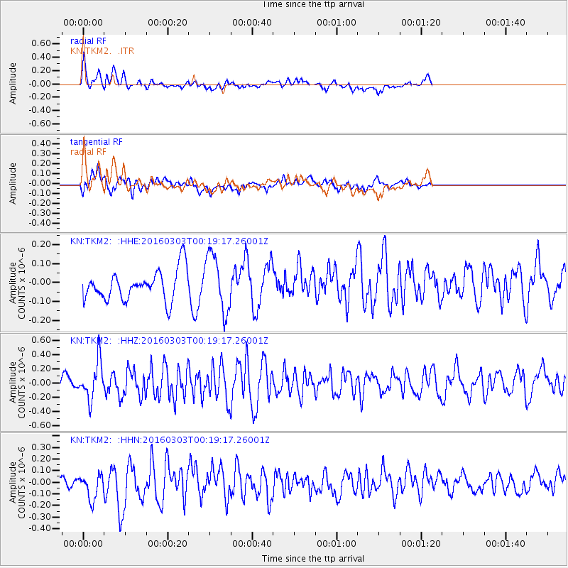
TKM2 - - Earthquake Result Viewer
*The percent match for this event was below the threshold and hence no stack was calculated.
| Earthquake location: |
Southwest Of Sumatra, Indonesia |
| Earthquake latitude/longitude: |
-4.8/94.4 |
| Earthquake time(UTC): |
2016/03/03 (063) 00:10:50 GMT |
| Earthquake Depth: |
10 km |
| Earthquake Magnitude: |
5.5 MB |
| Earthquake Catalog/Contributor: |
NEIC PDE/NEIC COMCAT |
|
| Network: |
KN Kyrgyz Seismic Telemetry Network |
| Station: |
TKM2 - |
| Lat/Lon: |
42.92 N/75.60 E |
| Elevation: |
2020 m |
|
| Distance: |
50.5 deg |
| Az: |
342.12 deg |
| Baz: |
155.386 deg |
| Ray Param: |
$rayparam |
*The percent match for this event was below the threshold and hence was not used in the summary stack. |
|
| Radial Match: |
74.505585 % |
| Radial Bump: |
400 |
| Transverse Match: |
61.060665 % |
| Transverse Bump: |
400 |
| SOD ConfigId: |
7422571 |
| Insert Time: |
2019-04-21 23:59:57.404 +0000 |
| GWidth: |
2.5 |
| Max Bumps: |
400 |
| Tol: |
0.001 |
|
Signal To Noise
| Channel | StoN | STA | LTA |
| KN:TKM2: :HHZ:20160303T00:19:17.26001Z | 3.2638237 | 2.7196091E-7 | 8.332585E-8 |
| KN:TKM2: :HHN:20160303T00:19:17.26001Z | 2.4722257 | 1.1718315E-7 | 4.739986E-8 |
| KN:TKM2: :HHE:20160303T00:19:17.26001Z | 1.9308456 | 1.5314673E-7 | 7.931589E-8 |
| Arrivals |
| Ps | |
| PpPs | |
| PsPs/PpSs | |


