WMQ Urumqi, Xinjiang Province, China - Earthquake Result Viewer
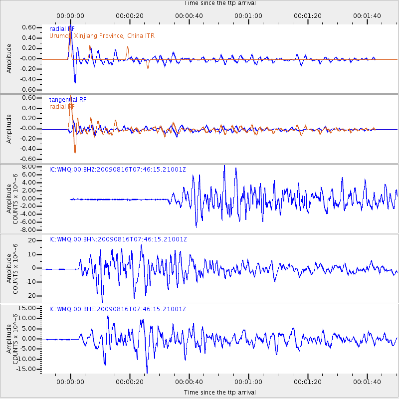
Earthquake location: Southern Sumatra, Indonesia
Earthquake latitude/longitude: -1.5/99.5
Earthquake time(UTC): 2009/08/16 (228) 07:38:21 GMT
Earthquake Depth: 20 km
Earthquake Magnitude: 6.5 MB, 6.7 MS, 6.7 MW, 6.5 MW
Earthquake Catalog/Contributor: WHDF/NEIC
Network: IC New China Digital Seismograph Network
Station: WMQ Urumqi, Xinjiang Province, China
Lat/Lon: 43.82 N/87.69 E
Elevation: 903 m
Distance: 46.3 deg
Az: 348.195 deg
Baz: 163.588 deg
Ray Param: 0.0706916
Estimated Moho Depth: 61.25 km
Estimated Crust Vp/Vs: 1.69
Assumed Crust Vp: 6.242 km/s
Estimated Crust Vs: 3.699 km/s
Estimated Crust Poisson's Ratio: 0.23
Radial Match: 95.83217 %
Radial Bump: 393
Transverse Match: 90.940475 %
Transverse Bump: 400
SOD ConfigId: 2622
Insert Time: 2010-03-05 00:17:40.651 +0000
GWidth: 2.5
Max Bumps: 400
Tol: 0.001

Signal To Noise

ChannelStoNSTALTA
IC:WMQ:00:BHN:20090816T07:46:15.21001Z20.5680732.3715074E-61.1530042E-7
IC:WMQ:00:BHE:20090816T07:46:15.21001Z12.3615431.0430833E-68.438133E-8
IC:WMQ:00:BHZ:20090816T07:46:15.21001Z9.3426675.6676816E-76.06645E-8
Arrivals
Ps7.2 SECOND
PpPs25 SECOND
PsPs/PpSs32 SECOND