You are here: Home > Network List > CI - Caltech Regional Seismic Network Stations List
> Station SMM Simmler, CA, USA > Earthquake Result Viewer
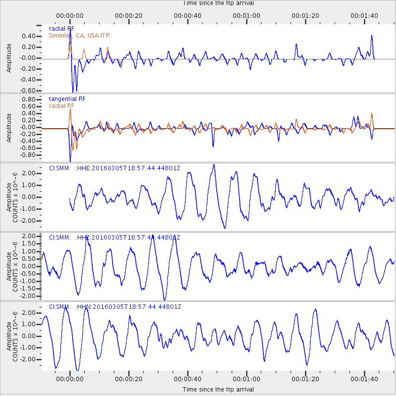
SMM Simmler, CA, USA - Earthquake Result Viewer
*The percent match for this event was below the threshold and hence no stack was calculated.
| Earthquake location: |
South Of Kermadec Islands |
| Earthquake latitude/longitude: |
-32.9/-178.2 |
| Earthquake time(UTC): |
2016/03/05 (065) 18:45:30 GMT |
| Earthquake Depth: |
10 km |
| Earthquake Magnitude: |
5.5 MB |
| Earthquake Catalog/Contributor: |
NEIC PDE/NEIC COMCAT |
|
| Network: |
CI Caltech Regional Seismic Network |
| Station: |
SMM Simmler, CA, USA |
| Lat/Lon: |
35.31 N/120.00 W |
| Elevation: |
599 m |
|
| Distance: |
87.1 deg |
| Az: |
44.107 deg |
| Baz: |
225.71 deg |
| Ray Param: |
$rayparam |
*The percent match for this event was below the threshold and hence was not used in the summary stack. |
|
| Radial Match: |
59.386356 % |
| Radial Bump: |
400 |
| Transverse Match: |
53.61109 % |
| Transverse Bump: |
400 |
| SOD ConfigId: |
7422571 |
| Insert Time: |
2019-04-22 00:17:04.895 +0000 |
| GWidth: |
2.5 |
| Max Bumps: |
400 |
| Tol: |
0.001 |
|
Signal To Noise
| Channel | StoN | STA | LTA |
| CI:SMM: :HHZ:20160305T18:57:44.44801Z | 1.4091674 | 1.092053E-6 | 7.749634E-7 |
| CI:SMM: :HHN:20160305T18:57:44.44801Z | 1.4391086 | 1.8293604E-6 | 1.271176E-6 |
| CI:SMM: :HHE:20160305T18:57:44.44801Z | 1.9900346 | 1.0722629E-6 | 5.388162E-7 |
| Arrivals |
| Ps | |
| PpPs | |
| PsPs/PpSs | |


