You are here: Home > Network List > TA - USArray Transportable Network (new EarthScope stations) Stations List
> Station O03E Paynes Creek, CA, USA > Earthquake Result Viewer
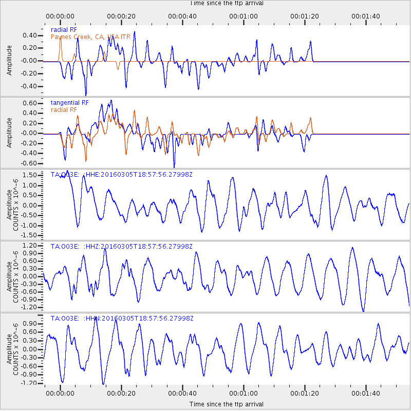
O03E Paynes Creek, CA, USA - Earthquake Result Viewer
*The percent match for this event was below the threshold and hence no stack was calculated.
| Earthquake location: |
South Of Kermadec Islands |
| Earthquake latitude/longitude: |
-32.9/-178.2 |
| Earthquake time(UTC): |
2016/03/05 (065) 18:45:30 GMT |
| Earthquake Depth: |
10 km |
| Earthquake Magnitude: |
5.5 MB |
| Earthquake Catalog/Contributor: |
NEIC PDE/NEIC COMCAT |
|
| Network: |
TA USArray Transportable Network (new EarthScope stations) |
| Station: |
O03E Paynes Creek, CA, USA |
| Lat/Lon: |
40.29 N/121.80 W |
| Elevation: |
967 m |
|
| Distance: |
89.6 deg |
| Az: |
39.574 deg |
| Baz: |
224.473 deg |
| Ray Param: |
$rayparam |
*The percent match for this event was below the threshold and hence was not used in the summary stack. |
|
| Radial Match: |
59.39633 % |
| Radial Bump: |
400 |
| Transverse Match: |
70.83789 % |
| Transverse Bump: |
400 |
| SOD ConfigId: |
7422571 |
| Insert Time: |
2019-04-22 00:18:53.784 +0000 |
| GWidth: |
2.5 |
| Max Bumps: |
400 |
| Tol: |
0.001 |
|
Signal To Noise
| Channel | StoN | STA | LTA |
| TA:O03E: :HHZ:20160305T18:57:56.27998Z | 1.5258349 | 3.8015645E-7 | 2.4914652E-7 |
| TA:O03E: :HHN:20160305T18:57:56.27998Z | 1.1554265 | 6.5807706E-7 | 5.695534E-7 |
| TA:O03E: :HHE:20160305T18:57:56.27998Z | 0.8826078 | 6.7811914E-7 | 7.683131E-7 |
| Arrivals |
| Ps | |
| PpPs | |
| PsPs/PpSs | |


