You are here: Home > Network List > TA - USArray Transportable Network (new EarthScope stations) Stations List
> Station MDND Maddock, ND, USA > Earthquake Result Viewer
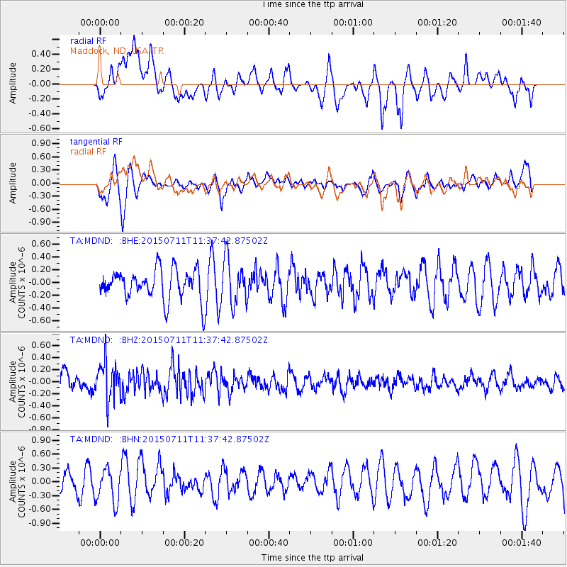
MDND Maddock, ND, USA - Earthquake Result Viewer
*The percent match for this event was below the threshold and hence no stack was calculated.
| Earthquake location: |
East Of Kuril Islands |
| Earthquake latitude/longitude: |
43.9/148.0 |
| Earthquake time(UTC): |
2015/07/11 (192) 11:26:59 GMT |
| Earthquake Depth: |
32 km |
| Earthquake Magnitude: |
5.5 MB |
| Earthquake Catalog/Contributor: |
NEIC PDE/NEIC COMCAT |
|
| Network: |
TA USArray Transportable Network (new EarthScope stations) |
| Station: |
MDND Maddock, ND, USA |
| Lat/Lon: |
47.85 N/99.60 W |
| Elevation: |
479 m |
|
| Distance: |
71.0 deg |
| Az: |
41.203 deg |
| Baz: |
315.014 deg |
| Ray Param: |
$rayparam |
*The percent match for this event was below the threshold and hence was not used in the summary stack. |
|
| Radial Match: |
53.43751 % |
| Radial Bump: |
400 |
| Transverse Match: |
71.40695 % |
| Transverse Bump: |
400 |
| SOD ConfigId: |
1085051 |
| Insert Time: |
2015-07-25 12:38:18.856 +0000 |
| GWidth: |
2.5 |
| Max Bumps: |
400 |
| Tol: |
0.001 |
|
Signal To Noise
| Channel | StoN | STA | LTA |
| TA:MDND: :BHZ:20150711T11:37:42.87502Z | 2.2806354 | 3.150092E-7 | 1.3812344E-7 |
| TA:MDND: :BHN:20150711T11:37:42.87502Z | 1.7293934 | 3.6599354E-7 | 2.1163117E-7 |
| TA:MDND: :BHE:20150711T11:37:42.87502Z | 1.4911836 | 3.516776E-7 | 2.3583789E-7 |
| Arrivals |
| Ps | |
| PpPs | |
| PsPs/PpSs | |


