You are here: Home > Network List > IC - New China Digital Seismograph Network Stations List
> Station WMQ Urumqi, Xinjiang Province, China > Earthquake Result Viewer
WMQ Urumqi, Xinjiang Province, China - Earthquake Result Viewer

| Earthquake location: |
Ceram Sea |
| Earthquake latitude/longitude: |
-2.1/124.9 |
| Earthquake time(UTC): |
1998/11/29 (333) 14:10:31 GMT |
| Earthquake Depth: |
33 km |
| Earthquake Magnitude: |
6.5 MB, 7.7 MS, 8.1 UNKNOWN, 7.8 MW |
| Earthquake Catalog/Contributor: |
WHDF/NEIC |
|
| Network: |
IC New China Digital Seismograph Network |
| Station: |
WMQ Urumqi, Xinjiang Province, China |
| Lat/Lon: |
43.82 N/87.69 E |
| Elevation: |
903 m |
|
| Distance: |
56.5 deg |
| Az: |
328.362 deg |
| Baz: |
133.596 deg |
| Ray Param: |
0.06402027 |
| Estimated Moho Depth: |
39.5 km |
| Estimated Crust Vp/Vs: |
2.10 |
| Assumed Crust Vp: |
6.242 km/s |
| Estimated Crust Vs: |
2.976 km/s |
| Estimated Crust Poisson's Ratio: |
0.35 |
|
| Radial Match: |
96.72099 % |
| Radial Bump: |
300 |
| Transverse Match: |
86.229904 % |
| Transverse Bump: |
400 |
| SOD ConfigId: |
4480 |
| Insert Time: |
2010-03-05 00:19:27.144 +0000 |
| GWidth: |
2.5 |
| Max Bumps: |
400 |
| Tol: |
0.001 |
|
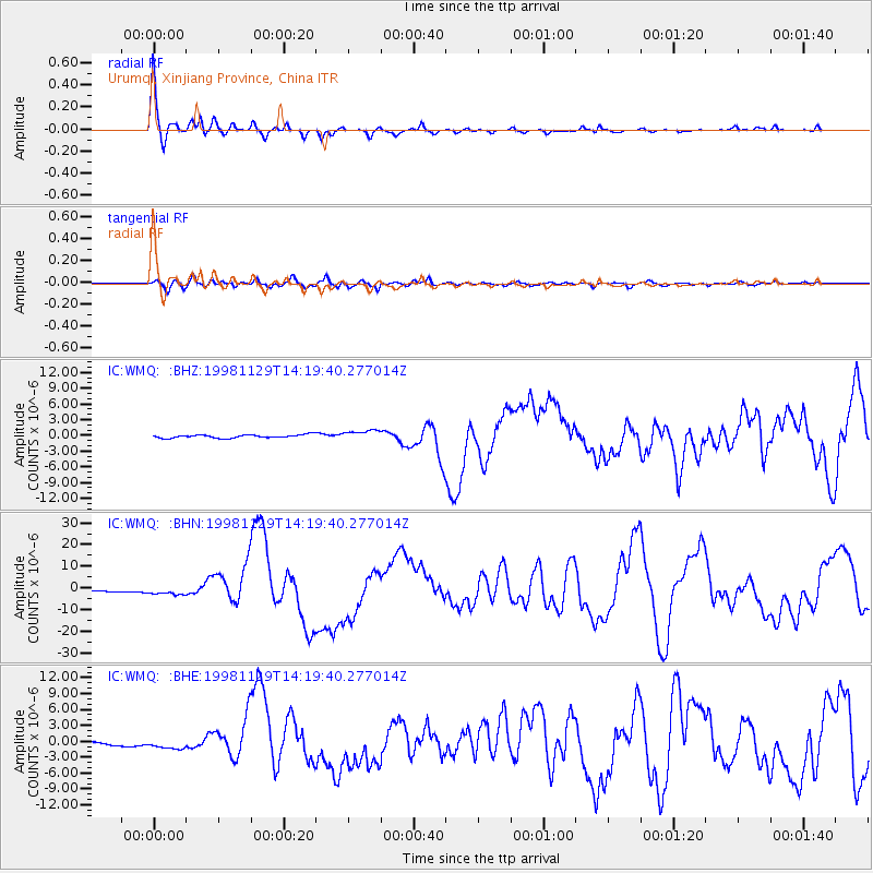
Signal To Noise
| Channel | StoN | STA | LTA |
| IC:WMQ: :BHN:19981129T14:19:40.277014Z | 4.203077 | 1.8724517E-6 | 4.4549546E-7 |
| IC:WMQ: :BHE:19981129T14:19:40.277014Z | 2.6527917 | 8.550355E-7 | 3.2231534E-7 |
| IC:WMQ: :BHZ:19981129T14:19:40.277014Z | 3.1147707 | 9.5311776E-7 | 3.0599935E-7 |
| Arrivals |
| Ps | 7.2 SECOND |
| PpPs | 19 SECOND |
| PsPs/PpSs | 26 SECOND |


