You are here: Home > Network List > TA - USArray Transportable Network (new EarthScope stations) Stations List
> Station I23K Minto, Yukon-Koyukuk, AK, USA > Earthquake Result Viewer
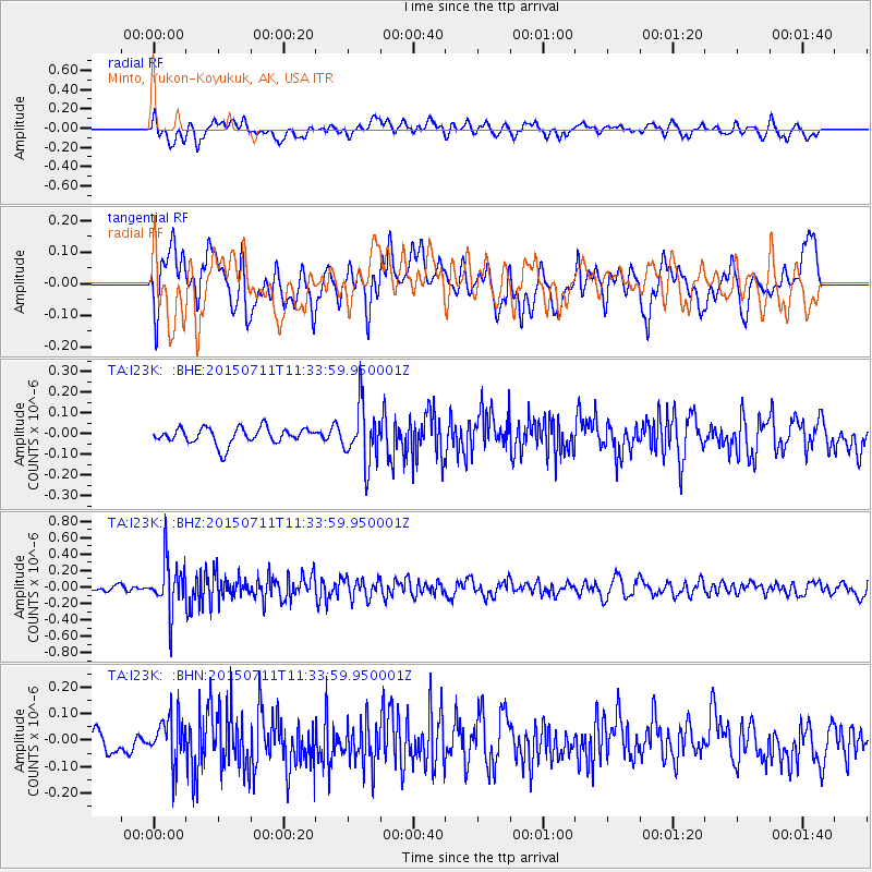
I23K Minto, Yukon-Koyukuk, AK, USA - Earthquake Result Viewer
*The percent match for this event was below the threshold and hence no stack was calculated.
| Earthquake location: |
East Of Kuril Islands |
| Earthquake latitude/longitude: |
43.9/148.0 |
| Earthquake time(UTC): |
2015/07/11 (192) 11:26:59 GMT |
| Earthquake Depth: |
32 km |
| Earthquake Magnitude: |
5.5 MB |
| Earthquake Catalog/Contributor: |
NEIC PDE/NEIC COMCAT |
|
| Network: |
TA USArray Transportable Network (new EarthScope stations) |
| Station: |
I23K Minto, Yukon-Koyukuk, AK, USA |
| Lat/Lon: |
65.15 N/149.36 W |
| Elevation: |
149 m |
|
| Distance: |
39.9 deg |
| Az: |
35.772 deg |
| Baz: |
269.167 deg |
| Ray Param: |
$rayparam |
*The percent match for this event was below the threshold and hence was not used in the summary stack. |
|
| Radial Match: |
45.60008 % |
| Radial Bump: |
400 |
| Transverse Match: |
58.010483 % |
| Transverse Bump: |
400 |
| SOD ConfigId: |
1085051 |
| Insert Time: |
2015-07-25 12:39:28.365 +0000 |
| GWidth: |
2.5 |
| Max Bumps: |
400 |
| Tol: |
0.001 |
|
Signal To Noise
| Channel | StoN | STA | LTA |
| TA:I23K: :BHZ:20150711T11:33:59.950001Z | 5.402751 | 3.0102083E-7 | 5.5716214E-8 |
| TA:I23K: :BHN:20150711T11:33:59.950001Z | 1.6424212 | 8.618196E-8 | 5.2472508E-8 |
| TA:I23K: :BHE:20150711T11:33:59.950001Z | 3.4961042 | 1.367681E-7 | 3.9120142E-8 |
| Arrivals |
| Ps | |
| PpPs | |
| PsPs/PpSs | |


