WMQ Urumqi, Xinjiang Province, China - Earthquake Result Viewer
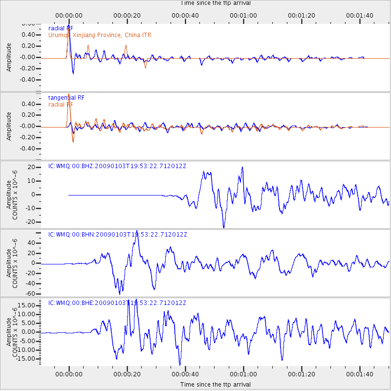
Earthquake location: Irian Jaya Region, Indonesia
Earthquake latitude/longitude: -0.4/132.9
Earthquake time(UTC): 2009/01/03 (003) 19:43:50 GMT
Earthquake Depth: 17 km
Earthquake Magnitude: 6.6 MB, 7.5 MS, 7.6 MW, 7.6 MW
Earthquake Catalog/Contributor: WHDF/NEIC
Network: IC New China Digital Seismograph Network
Station: WMQ Urumqi, Xinjiang Province, China
Lat/Lon: 43.82 N/87.69 E
Elevation: 903 m
Distance: 59.7 deg
Az: 323.486 deg
Baz: 124.712 deg
Ray Param: 0.06202716
Estimated Moho Depth: 48.75 km
Estimated Crust Vp/Vs: 1.72
Assumed Crust Vp: 6.242 km/s
Estimated Crust Vs: 3.624 km/s
Estimated Crust Poisson's Ratio: 0.25
Radial Match: 95.52951 %
Radial Bump: 400
Transverse Match: 90.25815 %
Transverse Bump: 400
SOD ConfigId: 2658
Insert Time: 2010-03-05 00:19:58.689 +0000
GWidth: 2.5
Max Bumps: 400
Tol: 0.001

Signal To Noise

ChannelStoNSTALTA
IC:WMQ:00:BHN:20090103T19:53:22.712012Z11.7021236.909028E-75.904081E-8
IC:WMQ:00:BHE:20090103T19:53:22.712012Z2.5271122.1661647E-78.5717005E-8
IC:WMQ:00:BHZ:20090103T19:53:22.712012Z4.82569272.8720996E-75.9516832E-8
Arrivals
Ps5.9 SECOND
PpPs20 SECOND
PsPs/PpSs26 SECOND