WMQ Urumqi, Xinjiang Province, China - Earthquake Result Viewer
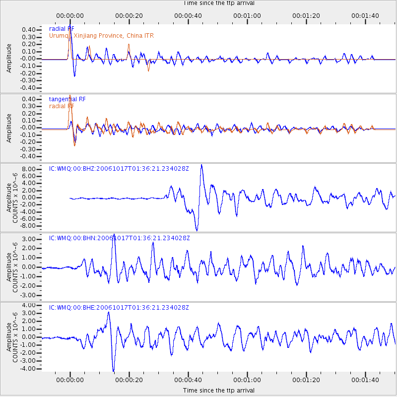
Earthquake location: New Britain Region, P.N.G.
Earthquake latitude/longitude: -5.9/151.0
Earthquake time(UTC): 2006/10/17 (290) 01:25:12 GMT
Earthquake Depth: 32 km
Earthquake Magnitude: 6.4 MB, 6.9 MS, 6.7 MW, 6.6 MW
Earthquake Catalog/Contributor: WHDF/NEIC
Network: IC New China Digital Seismograph Network
Station: WMQ Urumqi, Xinjiang Province, China
Lat/Lon: 43.82 N/87.69 E
Elevation: 903 m
Distance: 75.3 deg
Az: 318.057 deg
Baz: 113.274 deg
Ray Param: 0.05170488
Estimated Moho Depth: 54.25 km
Estimated Crust Vp/Vs: 1.66
Assumed Crust Vp: 6.242 km/s
Estimated Crust Vs: 3.766 km/s
Estimated Crust Poisson's Ratio: 0.21
Radial Match: 95.00611 %
Radial Bump: 400
Transverse Match: 89.38642 %
Transverse Bump: 400
SOD ConfigId: 2564
Insert Time: 2010-03-05 00:20:30.813 +0000
GWidth: 2.5
Max Bumps: 400
Tol: 0.001

Signal To Noise

ChannelStoNSTALTA
IC:WMQ:00:BHN:20061017T01:36:21.234028Z5.93220333.193673E-75.3836203E-8
IC:WMQ:00:BHE:20061017T01:36:21.234028Z6.89199455.1500945E-77.472575E-8
IC:WMQ:00:BHZ:20061017T01:36:21.234028Z13.965641.3983818E-61.00130165E-7
Arrivals
Ps5.9 SECOND
PpPs22 SECOND
PsPs/PpSs28 SECOND