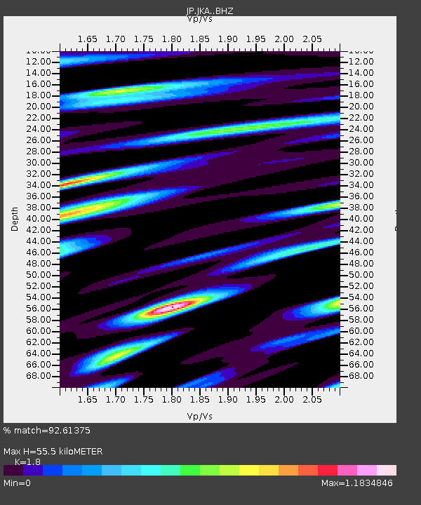
JKA Kamikawa Asahi - Earthquake Result Viewer

Earthquake location: Andreanof Islands, Aleutian Is.
Earthquake latitude/longitude: 51.6/-174.0
Earthquake time(UTC): 2016/03/12 (072) 18:06:45 GMT
Earthquake Depth: 19 km
Earthquake Magnitude: 6.3 MWW, 6.1 MB, 6.2 MWB, 6.3 MWC, 6.4 MWC, 6.4 MI
Earthquake Catalog/Contributor: NEIC PDE/NEIC COMCAT
Network: JP Japan Meteorological Agency Seismic Network
Station: JKA Kamikawa Asahi
Lat/Lon: 41.12 N/142.59 E
Elevation: 220 m
Distance: 31.3 deg
Az: 267.787 deg
Baz: 55.65 deg
Ray Param: 0.07909821
Estimated Moho Depth: 55.5 km
Estimated Crust Vp/Vs: 1.80
Assumed Crust Vp: 6.183 km/s
Estimated Crust Vs: 3.435 km/s
Estimated Crust Poisson's Ratio: 0.28
Radial Match: 92.61375 %
Radial Bump: 400
Transverse Match: 86.64927 %
Transverse Bump: 400
SOD ConfigId: 7422571
Insert Time: 2019-04-22 00:41:16.663 +0000
GWidth: 2.5
Max Bumps: 400
Tol: 0.001

Signal To Noise

ChannelStoNSTALTA
JP:JKA: :BHZ:20160312T18:12:19.300005Z1.20834641.2724292E-61.0530335E-6
JP:JKA: :BHN:20160312T18:12:19.300005Z2.71130858.513525E-73.1400063E-7
JP:JKA: :BHE:20160312T18:12:19.300005Z2.47819231.4677754E-65.9227665E-7
Arrivals
Ps7.7 SECOND
PpPs23 SECOND
PsPs/PpSs31 SECOND