You are here: Home > Network List > WY - Yellowstone Wyoming Seismic Network Stations List
> Station YHH Holmes Hill, YNP, WY, USA > Earthquake Result Viewer
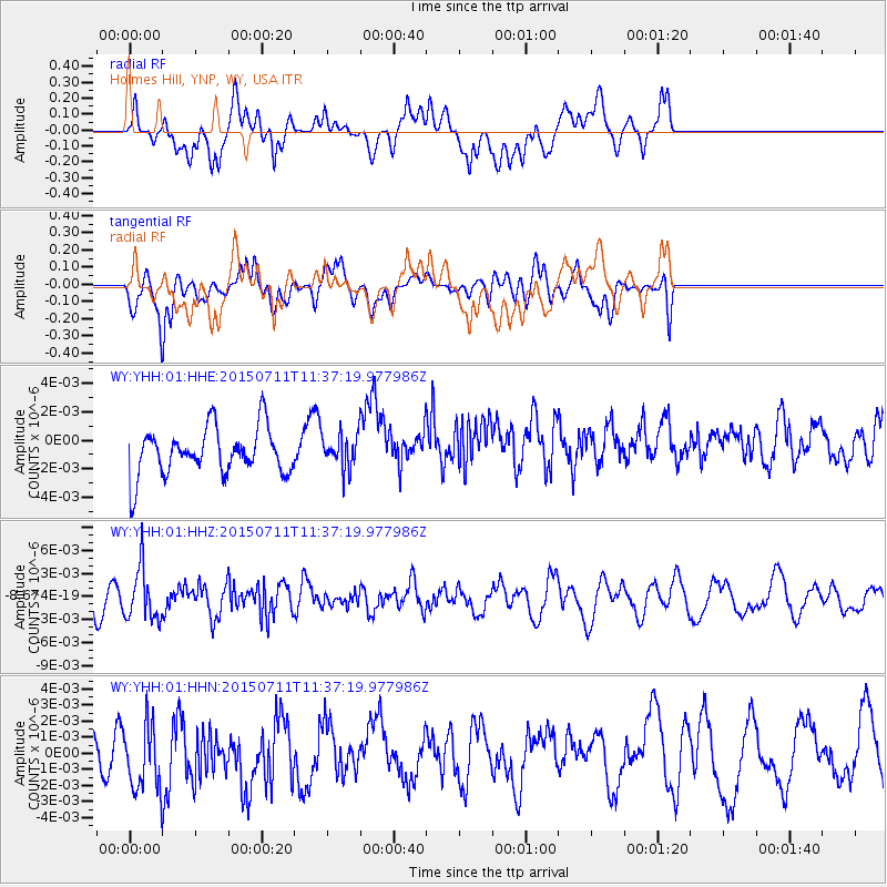
YHH Holmes Hill, YNP, WY, USA - Earthquake Result Viewer
*The percent match for this event was below the threshold and hence no stack was calculated.
| Earthquake location: |
East Of Kuril Islands |
| Earthquake latitude/longitude: |
43.9/148.0 |
| Earthquake time(UTC): |
2015/07/11 (192) 11:26:59 GMT |
| Earthquake Depth: |
32 km |
| Earthquake Magnitude: |
5.5 MB |
| Earthquake Catalog/Contributor: |
NEIC PDE/NEIC COMCAT |
|
| Network: |
WY Yellowstone Wyoming Seismic Network |
| Station: |
YHH Holmes Hill, YNP, WY, USA |
| Lat/Lon: |
44.79 N/110.85 W |
| Elevation: |
2717 m |
|
| Distance: |
67.3 deg |
| Az: |
49.23 deg |
| Baz: |
309.752 deg |
| Ray Param: |
$rayparam |
*The percent match for this event was below the threshold and hence was not used in the summary stack. |
|
| Radial Match: |
67.42567 % |
| Radial Bump: |
400 |
| Transverse Match: |
70.58725 % |
| Transverse Bump: |
400 |
| SOD ConfigId: |
1085051 |
| Insert Time: |
2015-07-25 12:43:42.277 +0000 |
| GWidth: |
2.5 |
| Max Bumps: |
400 |
| Tol: |
0.001 |
|
Signal To Noise
| Channel | StoN | STA | LTA |
| WY:YHH:01:HHZ:20150711T11:37:19.977986Z | 2.546089 | 3.4357093E-9 | 1.3494067E-9 |
| WY:YHH:01:HHN:20150711T11:37:19.977986Z | 1.6619148 | 2.1801827E-9 | 1.3118499E-9 |
| WY:YHH:01:HHE:20150711T11:37:19.977986Z | 0.69315004 | 1.1542616E-9 | 1.6652406E-9 |
| Arrivals |
| Ps | |
| PpPs | |
| PsPs/PpSs | |


