DIVS Divcibare,Serbia - Earthquake Result Viewer
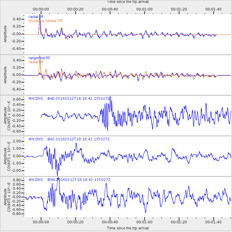
Earthquake location: Andreanof Islands, Aleutian Is.
Earthquake latitude/longitude: 51.6/-174.0
Earthquake time(UTC): 2016/03/12 (072) 18:06:45 GMT
Earthquake Depth: 19 km
Earthquake Magnitude: 6.3 MWW, 6.1 MB, 6.2 MWB, 6.3 MWC, 6.4 MWC, 6.4 MI
Earthquake Catalog/Contributor: NEIC PDE/NEIC COMCAT
Network: MN MEDNET Project
Station: DIVS Divcibare,Serbia
Lat/Lon: 44.10 N/19.99 E
Elevation: 1000 m
Distance: 83.9 deg
Az: 349.892 deg
Baz: 8.746 deg
Ray Param: 0.04580805
Estimated Moho Depth: 29.75 km
Estimated Crust Vp/Vs: 1.75
Assumed Crust Vp: 6.264 km/s
Estimated Crust Vs: 3.579 km/s
Estimated Crust Poisson's Ratio: 0.26
Radial Match: 92.20868 %
Radial Bump: 400
Transverse Match: 64.618004 %
Transverse Bump: 400
SOD ConfigId: 7422571
Insert Time: 2019-04-22 00:42:25.592 +0000
GWidth: 2.5
Max Bumps: 400
Tol: 0.001

Signal To Noise

ChannelStoNSTALTA
MN:DIVS: :BHZ:20160312T18:18:42.135027Z8.22736.765959E-78.2237904E-8
MN:DIVS: :BHN:20160312T18:18:42.135027Z4.770323.2389082E-76.789708E-8
MN:DIVS: :BHE:20160312T18:18:42.135027Z1.47722781.0572679E-77.157108E-8
Arrivals
Ps3.6 SECOND
PpPs13 SECOND
PsPs/PpSs16 SECOND