
WMQ Urumqi, Xinjiang Province, China - Earthquake Result Viewer
| ||||||||||||||||||
| ||||||||||||||||||
| ||||||||||||||||||
|
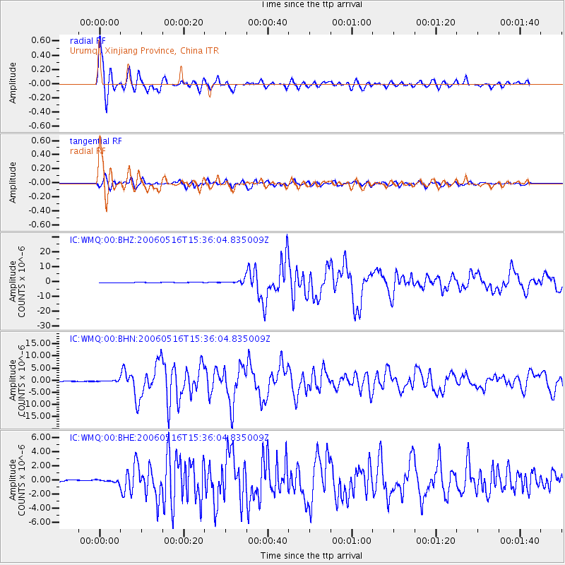
Signal To Noise
| Channel | StoN | STA | LTA |
| IC:WMQ:00:BHN:20060516T15:36:04.835009Z | 2.579291 | 3.657183E-7 | 1.4179024E-7 |
| IC:WMQ:00:BHE:20060516T15:36:04.835009Z | 1.5651265 | 1.8438067E-7 | 1.17805605E-7 |
| IC:WMQ:00:BHZ:20060516T15:36:04.835009Z | 8.482528 | 1.4120692E-6 | 1.6646797E-7 |
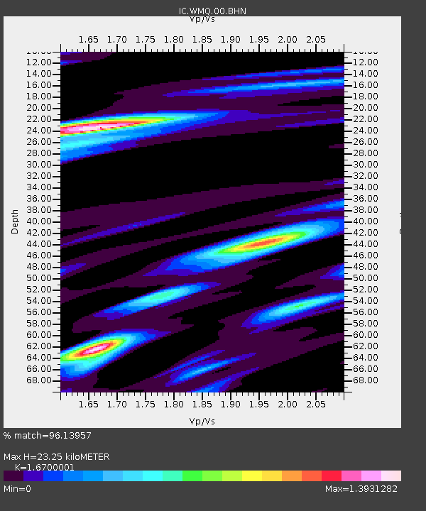
| Arrivals | |
| Ps | 2.7 SECOND |
| PpPs | 9.3 SECOND |
| PsPs/PpSs | 12 SECOND |

