BGNE Belgrade, NE, USA - Earthquake Result Viewer
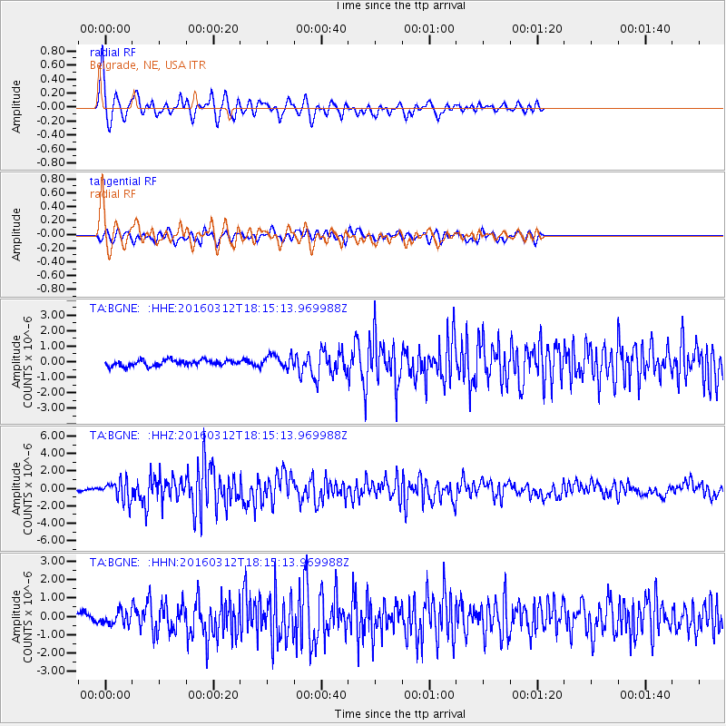
Earthquake location: Andreanof Islands, Aleutian Is.
Earthquake latitude/longitude: 51.6/-174.0
Earthquake time(UTC): 2016/03/12 (072) 18:06:45 GMT
Earthquake Depth: 19 km
Earthquake Magnitude: 6.3 MWW, 6.1 MB, 6.2 MWB, 6.3 MWC, 6.4 MWC, 6.4 MI
Earthquake Catalog/Contributor: NEIC PDE/NEIC COMCAT
Network: TA USArray Transportable Network (new EarthScope stations)
Station: BGNE Belgrade, NE, USA
Lat/Lon: 41.41 N/98.15 W
Elevation: 573 m
Distance: 51.0 deg
Az: 69.832 deg
Baz: 308.832 deg
Ray Param: 0.06766738
Estimated Moho Depth: 10.0 km
Estimated Crust Vp/Vs: 1.60
Assumed Crust Vp: 6.53 km/s
Estimated Crust Vs: 4.082 km/s
Estimated Crust Poisson's Ratio: 0.18
Radial Match: 88.06756 %
Radial Bump: 396
Transverse Match: 73.196365 %
Transverse Bump: 400
SOD ConfigId: 7422571
Insert Time: 2019-04-22 00:46:20.210 +0000
GWidth: 2.5
Max Bumps: 400
Tol: 0.001

Signal To Noise

ChannelStoNSTALTA
TA:BGNE: :HHZ:20160312T18:15:13.969988Z6.949781.1703677E-61.6840356E-7
TA:BGNE: :HHN:20160312T18:15:13.969988Z1.67050313.688084E-72.2077684E-7
TA:BGNE: :HHE:20160312T18:15:13.969988Z2.37052464.4889995E-71.8936734E-7
Arrivals
Ps1.0 SECOND
PpPs3.7 SECOND
PsPs/PpSs4.7 SECOND