T25A Trinidad, CO, USA - Earthquake Result Viewer
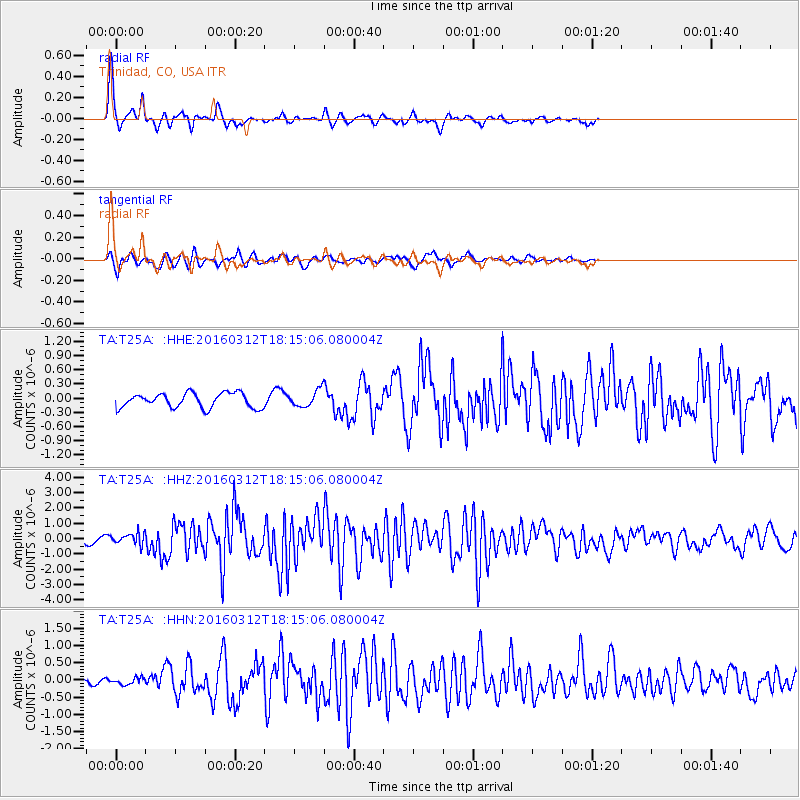
Earthquake location: Andreanof Islands, Aleutian Is.
Earthquake latitude/longitude: 51.6/-174.0
Earthquake time(UTC): 2016/03/12 (072) 18:06:45 GMT
Earthquake Depth: 19 km
Earthquake Magnitude: 6.3 MWW, 6.1 MB, 6.2 MWB, 6.3 MWC, 6.4 MWC, 6.4 MI
Earthquake Catalog/Contributor: NEIC PDE/NEIC COMCAT
Network: TA USArray Transportable Network (new EarthScope stations)
Station: T25A Trinidad, CO, USA
Lat/Lon: 37.14 N/104.41 W
Elevation: 2017 m
Distance: 50.0 deg
Az: 78.102 deg
Baz: 310.149 deg
Ray Param: 0.068350196
Estimated Moho Depth: 36.75 km
Estimated Crust Vp/Vs: 1.90
Assumed Crust Vp: 6.316 km/s
Estimated Crust Vs: 3.324 km/s
Estimated Crust Poisson's Ratio: 0.31
Radial Match: 89.723465 %
Radial Bump: 384
Transverse Match: 73.17088 %
Transverse Bump: 400
SOD ConfigId: 7422571
Insert Time: 2019-04-22 00:46:40.258 +0000
GWidth: 2.5
Max Bumps: 400
Tol: 0.001

Signal To Noise

ChannelStoNSTALTA
TA:T25A: :HHZ:20160312T18:15:06.080004Z2.43582223.636829E-71.49306E-7
TA:T25A: :HHN:20160312T18:15:06.080004Z0.98498869.5313084E-89.6765675E-8
TA:T25A: :HHE:20160312T18:15:06.080004Z1.39387572.0676971E-71.4834158E-7
Arrivals
Ps5.5 SECOND
PpPs16 SECOND
PsPs/PpSs22 SECOND