W39A Magazine, AR, USA - Earthquake Result Viewer
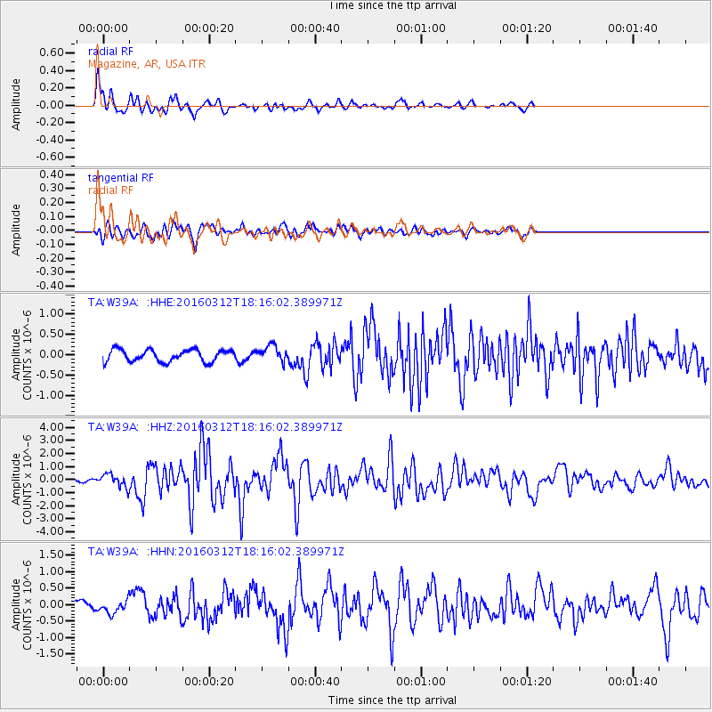
Earthquake location: Andreanof Islands, Aleutian Is.
Earthquake latitude/longitude: 51.6/-174.0
Earthquake time(UTC): 2016/03/12 (072) 18:06:45 GMT
Earthquake Depth: 19 km
Earthquake Magnitude: 6.3 MWW, 6.1 MB, 6.2 MWB, 6.3 MWC, 6.4 MWC, 6.4 MI
Earthquake Catalog/Contributor: NEIC PDE/NEIC COMCAT
Network: TA USArray Transportable Network (new EarthScope stations)
Station: W39A Magazine, AR, USA
Lat/Lon: 35.20 N/93.78 W
Elevation: 162 m
Distance: 57.7 deg
Az: 72.807 deg
Baz: 313.27 deg
Ray Param: 0.06332736
Estimated Moho Depth: 13.75 km
Estimated Crust Vp/Vs: 2.09
Assumed Crust Vp: 6.498 km/s
Estimated Crust Vs: 3.113 km/s
Estimated Crust Poisson's Ratio: 0.35
Radial Match: 89.89022 %
Radial Bump: 360
Transverse Match: 71.84694 %
Transverse Bump: 400
SOD ConfigId: 7422571
Insert Time: 2019-04-22 00:46:44.483 +0000
GWidth: 2.5
Max Bumps: 400
Tol: 0.001

Signal To Noise

ChannelStoNSTALTA
TA:W39A: :HHZ:20160312T18:16:02.389971Z3.41027365.0617916E-71.4842773E-7
TA:W39A: :HHN:20160312T18:16:02.389971Z2.52603961.9713731E-77.804205E-8
TA:W39A: :HHE:20160312T18:16:02.389971Z1.48819172.1390912E-71.4373761E-7
Arrivals
Ps2.4 SECOND
PpPs6.3 SECOND
PsPs/PpSs8.7 SECOND