WHTX Lake Whitney, Meridian, TX, USA - Earthquake Result Viewer
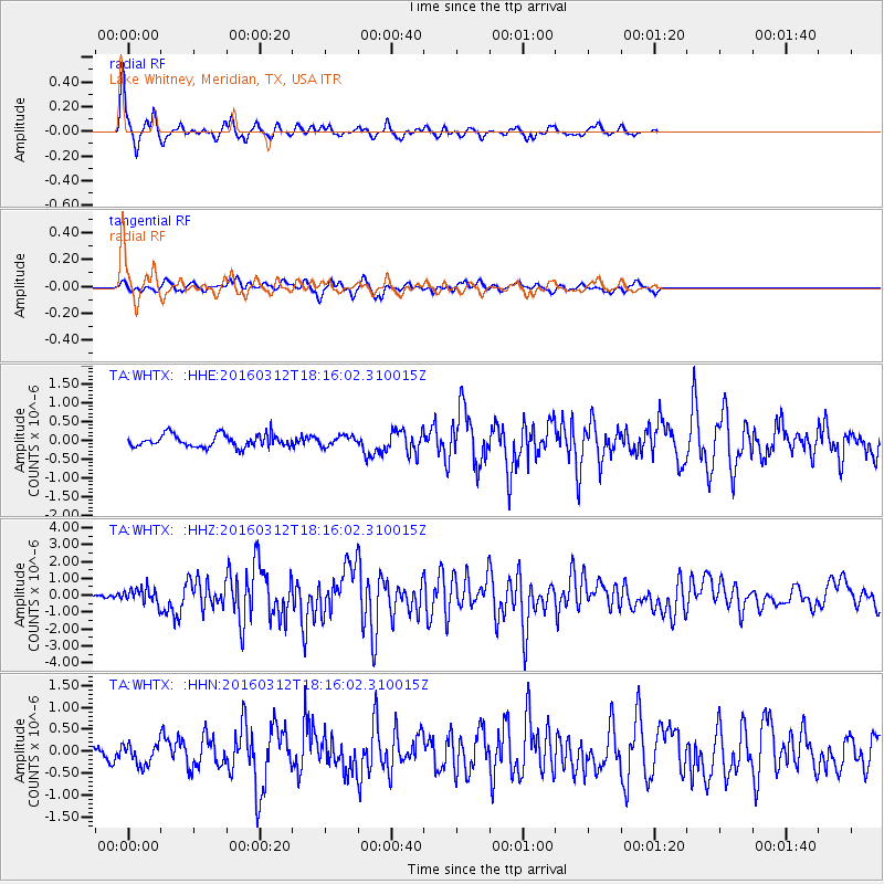
Earthquake location: Andreanof Islands, Aleutian Is.
Earthquake latitude/longitude: 51.6/-174.0
Earthquake time(UTC): 2016/03/12 (072) 18:06:45 GMT
Earthquake Depth: 19 km
Earthquake Magnitude: 6.3 MWW, 6.1 MB, 6.2 MWB, 6.3 MWC, 6.4 MWC, 6.4 MI
Earthquake Catalog/Contributor: NEIC PDE/NEIC COMCAT
Network: TA USArray Transportable Network (new EarthScope stations)
Station: WHTX Lake Whitney, Meridian, TX, USA
Lat/Lon: 31.99 N/97.46 W
Elevation: 190 m
Distance: 57.7 deg
Az: 78.048 deg
Baz: 314.052 deg
Ray Param: 0.06333483
Estimated Moho Depth: 13.25 km
Estimated Crust Vp/Vs: 1.60
Assumed Crust Vp: 6.347 km/s
Estimated Crust Vs: 3.967 km/s
Estimated Crust Poisson's Ratio: 0.18
Radial Match: 93.88549 %
Radial Bump: 271
Transverse Match: 76.70119 %
Transverse Bump: 400
SOD ConfigId: 7422571
Insert Time: 2019-04-22 00:46:44.841 +0000
GWidth: 2.5
Max Bumps: 400
Tol: 0.001

Signal To Noise

ChannelStoNSTALTA
TA:WHTX: :HHZ:20160312T18:16:02.310015Z4.2121824.7087644E-71.117892E-7
TA:WHTX: :HHN:20160312T18:16:02.310015Z1.89556772.5617203E-71.3514264E-7
TA:WHTX: :HHE:20160312T18:16:02.310015Z0.785759751.304314E-71.6599401E-7
Arrivals
Ps1.3 SECOND
PpPs5.1 SECOND
PsPs/PpSs6.5 SECOND