GARM Garm, Tajikistan - Earthquake Result Viewer
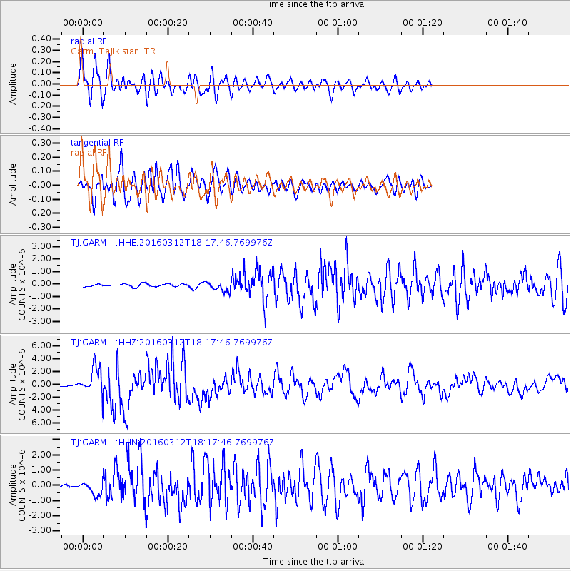
Earthquake location: Andreanof Islands, Aleutian Is.
Earthquake latitude/longitude: 51.6/-174.0
Earthquake time(UTC): 2016/03/12 (072) 18:06:45 GMT
Earthquake Depth: 19 km
Earthquake Magnitude: 6.3 MWW, 6.1 MB, 6.2 MWB, 6.3 MWC, 6.4 MWC, 6.4 MI
Earthquake Catalog/Contributor: NEIC PDE/NEIC COMCAT
Network: TJ Tajikistan National Seismic Network
Station: GARM Garm, Tajikistan
Lat/Lon: 39.00 N/70.32 E
Elevation: 1305 m
Distance: 73.8 deg
Az: 312.993 deg
Baz: 35.871 deg
Ray Param: 0.052746996
Estimated Moho Depth: 63.75 km
Estimated Crust Vp/Vs: 1.61
Assumed Crust Vp: 6.306 km/s
Estimated Crust Vs: 3.911 km/s
Estimated Crust Poisson's Ratio: 0.19
Radial Match: 87.03788 %
Radial Bump: 400
Transverse Match: 84.26895 %
Transverse Bump: 400
SOD ConfigId: 7422571
Insert Time: 2019-04-22 00:46:54.713 +0000
GWidth: 2.5
Max Bumps: 400
Tol: 0.001

Signal To Noise

ChannelStoNSTALTA
TJ:GARM: :HHZ:20160312T18:17:46.769976Z17.0573022.2441648E-61.3156621E-7
TJ:GARM: :HHN:20160312T18:17:46.769976Z4.7653944.7606864E-79.99012E-8
TJ:GARM: :HHE:20160312T18:17:46.769976Z3.88323144.4190287E-71.1379772E-7
Arrivals
Ps6.4 SECOND
PpPs25 SECOND
PsPs/PpSs32 SECOND