You are here: Home > Network List > AK - Alaska Regional Network Stations List
> Station CUT Chulitna, AK, USA > Earthquake Result Viewer
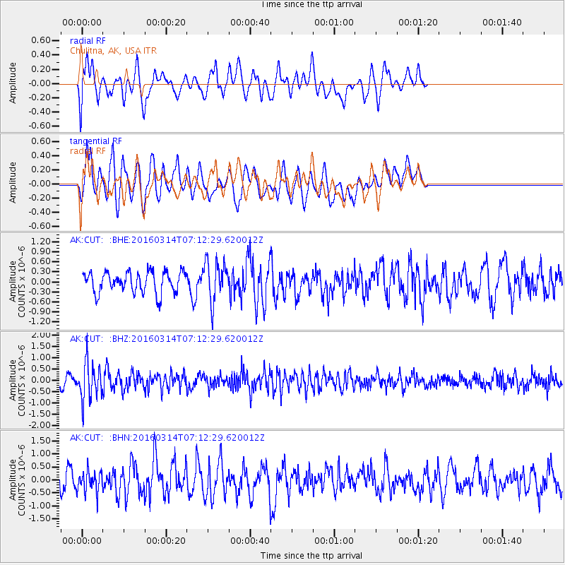
CUT Chulitna, AK, USA - Earthquake Result Viewer
*The percent match for this event was below the threshold and hence no stack was calculated.
| Earthquake location: |
Northwest Of Ryukyu Islands |
| Earthquake latitude/longitude: |
29.8/129.0 |
| Earthquake time(UTC): |
2016/03/14 (074) 07:03:17 GMT |
| Earthquake Depth: |
208 km |
| Earthquake Magnitude: |
5.5 MB |
| Earthquake Catalog/Contributor: |
NEIC PDE/NEIC COMCAT |
|
| Network: |
AK Alaska Regional Network |
| Station: |
CUT Chulitna, AK, USA |
| Lat/Lon: |
62.41 N/150.26 W |
| Elevation: |
574 m |
|
| Distance: |
59.8 deg |
| Az: |
32.131 deg |
| Baz: |
277.118 deg |
| Ray Param: |
$rayparam |
*The percent match for this event was below the threshold and hence was not used in the summary stack. |
|
| Radial Match: |
62.38479 % |
| Radial Bump: |
400 |
| Transverse Match: |
57.431572 % |
| Transverse Bump: |
400 |
| SOD ConfigId: |
7422571 |
| Insert Time: |
2019-04-22 00:49:59.116 +0000 |
| GWidth: |
2.5 |
| Max Bumps: |
400 |
| Tol: |
0.001 |
|
Signal To Noise
| Channel | StoN | STA | LTA |
| AK:CUT: :BHZ:20160314T07:12:29.620012Z | 4.6636696 | 8.40023E-7 | 1.8012061E-7 |
| AK:CUT: :BHN:20160314T07:12:29.620012Z | 1.0089145 | 3.9937484E-7 | 3.958461E-7 |
| AK:CUT: :BHE:20160314T07:12:29.620012Z | 1.9072278 | 5.948186E-7 | 3.11876E-7 |
| Arrivals |
| Ps | |
| PpPs | |
| PsPs/PpSs | |


