You are here: Home > Network List > AK - Alaska Regional Network Stations List
> Station MDM Murphy Dome > Earthquake Result Viewer
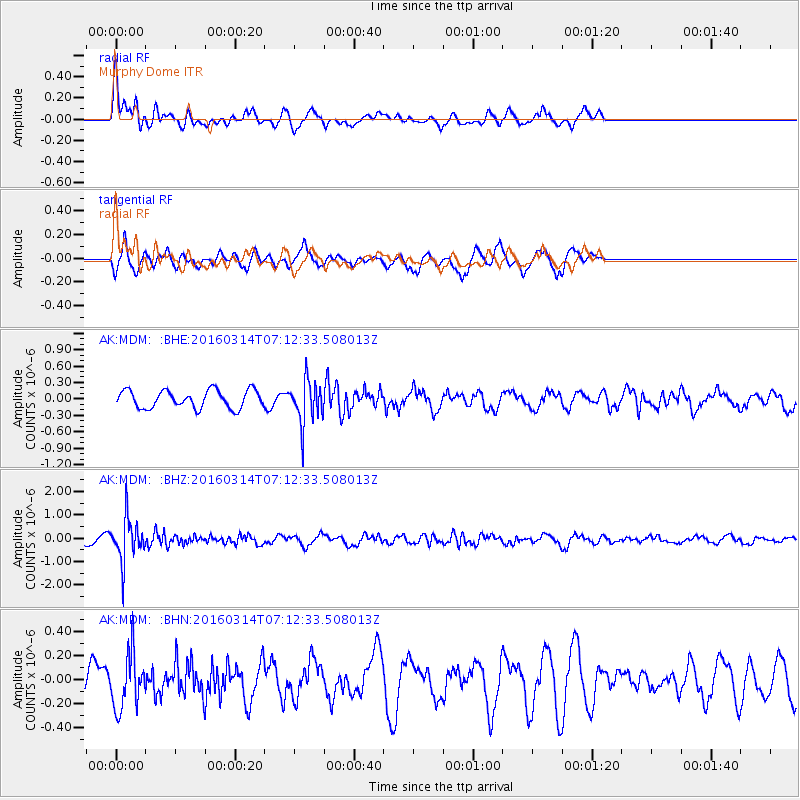
MDM Murphy Dome - Earthquake Result Viewer
*The percent match for this event was below the threshold and hence no stack was calculated.
| Earthquake location: |
Northwest Of Ryukyu Islands |
| Earthquake latitude/longitude: |
29.8/129.0 |
| Earthquake time(UTC): |
2016/03/14 (074) 07:03:17 GMT |
| Earthquake Depth: |
208 km |
| Earthquake Magnitude: |
5.5 MB |
| Earthquake Catalog/Contributor: |
NEIC PDE/NEIC COMCAT |
|
| Network: |
AK Alaska Regional Network |
| Station: |
MDM Murphy Dome |
| Lat/Lon: |
64.96 N/148.23 W |
| Elevation: |
634 m |
|
| Distance: |
60.4 deg |
| Az: |
29.065 deg |
| Baz: |
277.409 deg |
| Ray Param: |
$rayparam |
*The percent match for this event was below the threshold and hence was not used in the summary stack. |
|
| Radial Match: |
66.085175 % |
| Radial Bump: |
400 |
| Transverse Match: |
68.31684 % |
| Transverse Bump: |
390 |
| SOD ConfigId: |
7422571 |
| Insert Time: |
2019-04-22 00:50:12.065 +0000 |
| GWidth: |
2.5 |
| Max Bumps: |
400 |
| Tol: |
0.001 |
|
Signal To Noise
| Channel | StoN | STA | LTA |
| AK:MDM: :BHZ:20160314T07:12:33.508013Z | 5.1304526 | 9.2257864E-7 | 1.7982403E-7 |
| AK:MDM: :BHN:20160314T07:12:33.508013Z | 2.1215718 | 2.3110908E-7 | 1.0893295E-7 |
| AK:MDM: :BHE:20160314T07:12:33.508013Z | 2.4308877 | 3.962403E-7 | 1.630023E-7 |
| Arrivals |
| Ps | |
| PpPs | |
| PsPs/PpSs | |


