You are here: Home > Network List > IU - Global Seismograph Network (GSN - IRIS/USGS) Stations List
> Station CTAO Charters Towers, Australia > Earthquake Result Viewer
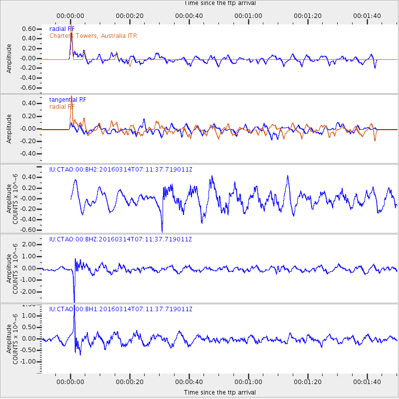
CTAO Charters Towers, Australia - Earthquake Result Viewer
*The percent match for this event was below the threshold and hence no stack was calculated.
| Earthquake location: |
Northwest Of Ryukyu Islands |
| Earthquake latitude/longitude: |
29.8/129.0 |
| Earthquake time(UTC): |
2016/03/14 (074) 07:03:17 GMT |
| Earthquake Depth: |
208 km |
| Earthquake Magnitude: |
5.5 MB |
| Earthquake Catalog/Contributor: |
NEIC PDE/NEIC COMCAT |
|
| Network: |
IU Global Seismograph Network (GSN - IRIS/USGS) |
| Station: |
CTAO Charters Towers, Australia |
| Lat/Lon: |
20.09 S/146.25 E |
| Elevation: |
357 m |
|
| Distance: |
52.4 deg |
| Az: |
159.364 deg |
| Baz: |
340.989 deg |
| Ray Param: |
$rayparam |
*The percent match for this event was below the threshold and hence was not used in the summary stack. |
|
| Radial Match: |
68.429115 % |
| Radial Bump: |
400 |
| Transverse Match: |
56.728935 % |
| Transverse Bump: |
391 |
| SOD ConfigId: |
7422571 |
| Insert Time: |
2019-04-22 00:52:43.125 +0000 |
| GWidth: |
2.5 |
| Max Bumps: |
400 |
| Tol: |
0.001 |
|
Signal To Noise
| Channel | StoN | STA | LTA |
| IU:CTAO:00:BHZ:20160314T07:11:37.719011Z | 2.6728437 | 6.906606E-7 | 2.5839918E-7 |
| IU:CTAO:00:BH1:20160314T07:11:37.719011Z | 2.535711 | 4.200301E-7 | 1.6564589E-7 |
| IU:CTAO:00:BH2:20160314T07:11:37.719011Z | 1.5559973 | 2.2239587E-7 | 1.4292819E-7 |
| Arrivals |
| Ps | |
| PpPs | |
| PsPs/PpSs | |


