You are here: Home > Network List > TA - USArray Transportable Network (new EarthScope stations) Stations List
> Station A21K Barrow, AK, USA > Earthquake Result Viewer
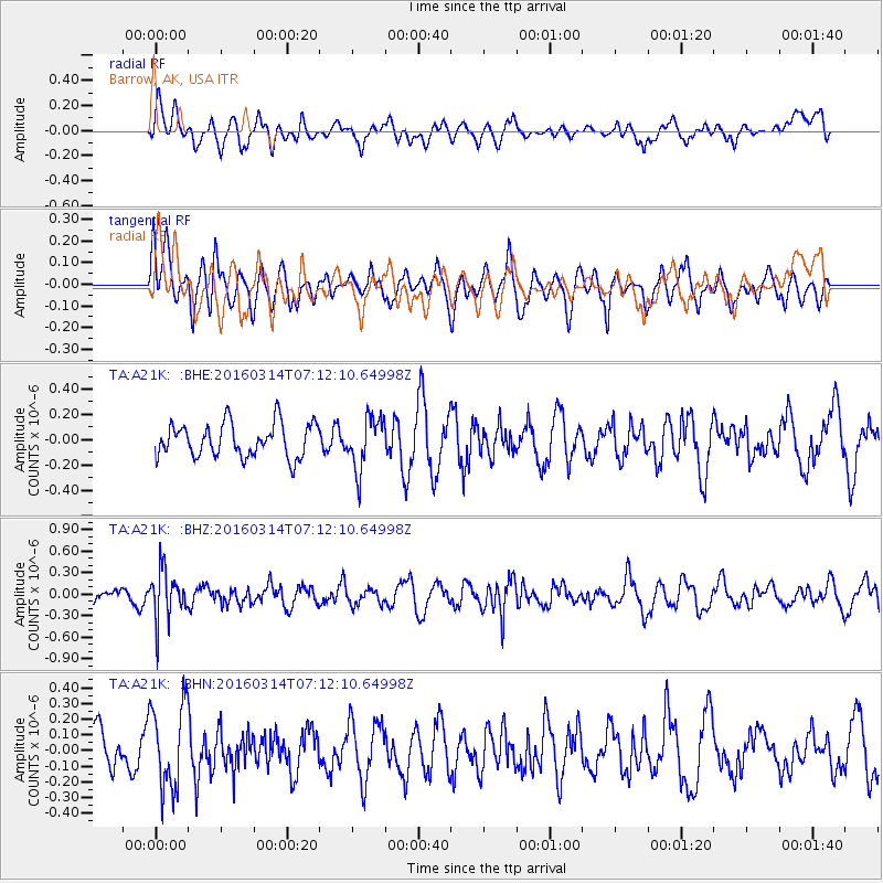
A21K Barrow, AK, USA - Earthquake Result Viewer
*The percent match for this event was below the threshold and hence no stack was calculated.
| Earthquake location: |
Northwest Of Ryukyu Islands |
| Earthquake latitude/longitude: |
29.8/129.0 |
| Earthquake time(UTC): |
2016/03/14 (074) 07:03:17 GMT |
| Earthquake Depth: |
208 km |
| Earthquake Magnitude: |
5.5 MB |
| Earthquake Catalog/Contributor: |
NEIC PDE/NEIC COMCAT |
|
| Network: |
TA USArray Transportable Network (new EarthScope stations) |
| Station: |
A21K Barrow, AK, USA |
| Lat/Lon: |
71.32 N/156.62 W |
| Elevation: |
577 m |
|
| Distance: |
57.0 deg |
| Az: |
21.706 deg |
| Baz: |
265.789 deg |
| Ray Param: |
$rayparam |
*The percent match for this event was below the threshold and hence was not used in the summary stack. |
|
| Radial Match: |
44.60676 % |
| Radial Bump: |
400 |
| Transverse Match: |
49.897053 % |
| Transverse Bump: |
373 |
| SOD ConfigId: |
7422571 |
| Insert Time: |
2019-04-22 00:54:10.205 +0000 |
| GWidth: |
2.5 |
| Max Bumps: |
400 |
| Tol: |
0.001 |
|
Signal To Noise
| Channel | StoN | STA | LTA |
| TA:A21K: :BHZ:20160314T07:12:10.64998Z | 2.8797581 | 3.5206185E-7 | 1.2225397E-7 |
| TA:A21K: :BHN:20160314T07:12:10.64998Z | 2.1727962 | 2.680021E-7 | 1.2334434E-7 |
| TA:A21K: :BHE:20160314T07:12:10.64998Z | 1.5571221 | 2.0688204E-7 | 1.328618E-7 |
| Arrivals |
| Ps | |
| PpPs | |
| PsPs/PpSs | |


