You are here: Home > Network List > TA - USArray Transportable Network (new EarthScope stations) Stations List
> Station J20K Nowitna River, AK, USA > Earthquake Result Viewer
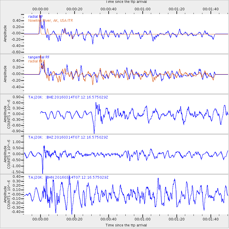
J20K Nowitna River, AK, USA - Earthquake Result Viewer
*The percent match for this event was below the threshold and hence no stack was calculated.
| Earthquake location: |
Northwest Of Ryukyu Islands |
| Earthquake latitude/longitude: |
29.8/129.0 |
| Earthquake time(UTC): |
2016/03/14 (074) 07:03:17 GMT |
| Earthquake Depth: |
208 km |
| Earthquake Magnitude: |
5.5 MB |
| Earthquake Catalog/Contributor: |
NEIC PDE/NEIC COMCAT |
|
| Network: |
TA USArray Transportable Network (new EarthScope stations) |
| Station: |
J20K Nowitna River, AK, USA |
| Lat/Lon: |
64.18 N/154.15 W |
| Elevation: |
314 m |
|
| Distance: |
57.9 deg |
| Az: |
30.237 deg |
| Baz: |
272.672 deg |
| Ray Param: |
$rayparam |
*The percent match for this event was below the threshold and hence was not used in the summary stack. |
|
| Radial Match: |
55.758396 % |
| Radial Bump: |
400 |
| Transverse Match: |
71.74165 % |
| Transverse Bump: |
400 |
| SOD ConfigId: |
7422571 |
| Insert Time: |
2019-04-22 00:54:20.291 +0000 |
| GWidth: |
2.5 |
| Max Bumps: |
400 |
| Tol: |
0.001 |
|
Signal To Noise
| Channel | StoN | STA | LTA |
| TA:J20K: :BHZ:20160314T07:12:16.575029Z | 4.7768493 | 4.4778193E-7 | 9.374001E-8 |
| TA:J20K: :BHN:20160314T07:12:16.575029Z | 1.3968296 | 1.4747076E-7 | 1.0557533E-7 |
| TA:J20K: :BHE:20160314T07:12:16.575029Z | 3.0951827 | 4.1802969E-7 | 1.3505817E-7 |
| Arrivals |
| Ps | |
| PpPs | |
| PsPs/PpSs | |


