You are here: Home > Network List > IC - New China Digital Seismograph Network Stations List
> Station WMQ Urumqi, Xinjiang Province, China > Earthquake Result Viewer
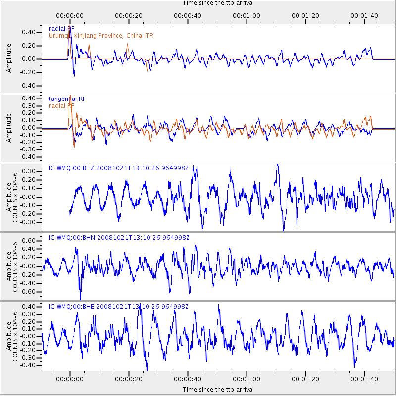
WMQ Urumqi, Xinjiang Province, China - Earthquake Result Viewer
*The percent match for this event was below the threshold and hence no stack was calculated.
| Earthquake location: |
Banda Sea |
| Earthquake latitude/longitude: |
-7.5/127.7 |
| Earthquake time(UTC): |
2008/10/21 (295) 13:00:48 GMT |
| Earthquake Depth: |
135 km |
| Earthquake Magnitude: |
5.5 MB, 5.6 MW, 5.5 MW |
| Earthquake Catalog/Contributor: |
WHDF/NEIC |
|
| Network: |
IC New China Digital Seismograph Network |
| Station: |
WMQ Urumqi, Xinjiang Province, China |
| Lat/Lon: |
43.82 N/87.69 E |
| Elevation: |
903 m |
|
| Distance: |
62.6 deg |
| Az: |
328.363 deg |
| Baz: |
134.061 deg |
| Ray Param: |
$rayparam |
*The percent match for this event was below the threshold and hence was not used in the summary stack. |
|
| Radial Match: |
45.185455 % |
| Radial Bump: |
400 |
| Transverse Match: |
66.06272 % |
| Transverse Bump: |
382 |
| SOD ConfigId: |
2658 |
| Insert Time: |
2010-03-05 00:24:49.296 +0000 |
| GWidth: |
2.5 |
| Max Bumps: |
400 |
| Tol: |
0.001 |
|
Signal To Noise
| Channel | StoN | STA | LTA |
| IC:WMQ:00:BHN:20081021T13:10:26.964998Z | 2.7417507 | 2.754593E-7 | 1.004684E-7 |
| IC:WMQ:00:BHE:20081021T13:10:26.964998Z | 1.4583284 | 1.665131E-7 | 1.1418081E-7 |
| IC:WMQ:00:BHZ:20081021T13:10:26.964998Z | 0.9436214 | 1.05074776E-7 | 1.1135268E-7 |
| Arrivals |
| Ps | |
| PpPs | |
| PsPs/PpSs | |


