You are here: Home > Network List > TA - USArray Transportable Network (new EarthScope stations) Stations List
> Station L20K Farewell, AK, USA > Earthquake Result Viewer
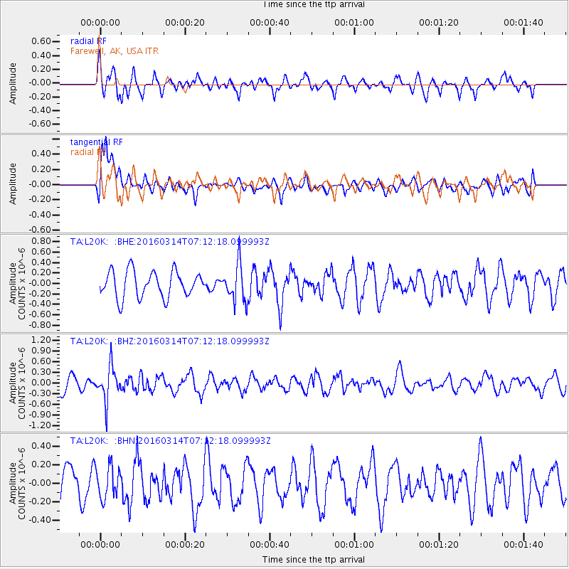
L20K Farewell, AK, USA - Earthquake Result Viewer
*The percent match for this event was below the threshold and hence no stack was calculated.
| Earthquake location: |
Northwest Of Ryukyu Islands |
| Earthquake latitude/longitude: |
29.8/129.0 |
| Earthquake time(UTC): |
2016/03/14 (074) 07:03:17 GMT |
| Earthquake Depth: |
208 km |
| Earthquake Magnitude: |
5.5 MB |
| Earthquake Catalog/Contributor: |
NEIC PDE/NEIC COMCAT |
|
| Network: |
TA USArray Transportable Network (new EarthScope stations) |
| Station: |
L20K Farewell, AK, USA |
| Lat/Lon: |
62.48 N/153.88 W |
| Elevation: |
673 m |
|
| Distance: |
58.1 deg |
| Az: |
32.236 deg |
| Baz: |
273.97 deg |
| Ray Param: |
$rayparam |
*The percent match for this event was below the threshold and hence was not used in the summary stack. |
|
| Radial Match: |
61.626137 % |
| Radial Bump: |
395 |
| Transverse Match: |
58.312527 % |
| Transverse Bump: |
400 |
| SOD ConfigId: |
7422571 |
| Insert Time: |
2019-04-22 00:54:25.921 +0000 |
| GWidth: |
2.5 |
| Max Bumps: |
400 |
| Tol: |
0.001 |
|
Signal To Noise
| Channel | StoN | STA | LTA |
| TA:L20K: :BHZ:20160314T07:12:18.099993Z | 2.9549441 | 4.860738E-7 | 1.644951E-7 |
| TA:L20K: :BHN:20160314T07:12:18.099993Z | 0.63194686 | 1.6867972E-7 | 2.6692072E-7 |
| TA:L20K: :BHE:20160314T07:12:18.099993Z | 1.466489 | 3.675324E-7 | 2.5062064E-7 |
| Arrivals |
| Ps | |
| PpPs | |
| PsPs/PpSs | |


