You are here: Home > Network List > TJ - Tajikistan National Seismic Network Stations List
> Station GARM Garm, Tajikistan > Earthquake Result Viewer
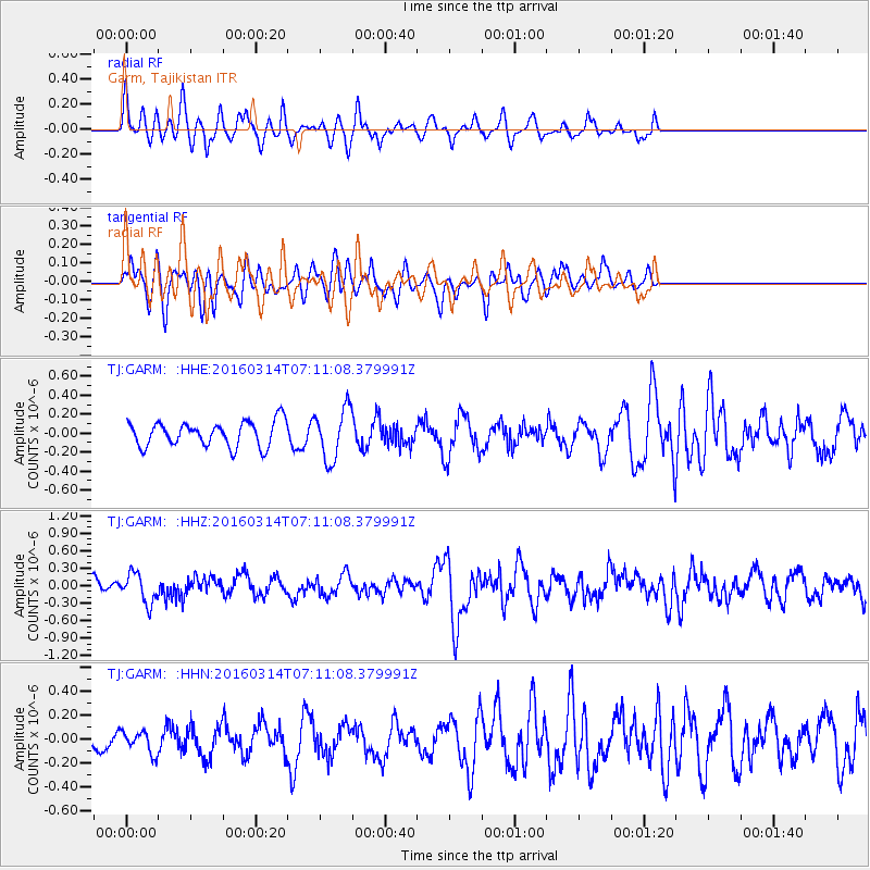
GARM Garm, Tajikistan - Earthquake Result Viewer
*The percent match for this event was below the threshold and hence no stack was calculated.
| Earthquake location: |
Northwest Of Ryukyu Islands |
| Earthquake latitude/longitude: |
29.8/129.0 |
| Earthquake time(UTC): |
2016/03/14 (074) 07:03:17 GMT |
| Earthquake Depth: |
208 km |
| Earthquake Magnitude: |
5.5 MB |
| Earthquake Catalog/Contributor: |
NEIC PDE/NEIC COMCAT |
|
| Network: |
TJ Tajikistan National Seismic Network |
| Station: |
GARM Garm, Tajikistan |
| Lat/Lon: |
39.00 N/70.32 E |
| Elevation: |
1305 m |
|
| Distance: |
48.5 deg |
| Az: |
297.323 deg |
| Baz: |
82.121 deg |
| Ray Param: |
$rayparam |
*The percent match for this event was below the threshold and hence was not used in the summary stack. |
|
| Radial Match: |
72.92524 % |
| Radial Bump: |
400 |
| Transverse Match: |
56.483097 % |
| Transverse Bump: |
364 |
| SOD ConfigId: |
7422571 |
| Insert Time: |
2019-04-22 00:54:40.619 +0000 |
| GWidth: |
2.5 |
| Max Bumps: |
400 |
| Tol: |
0.001 |
|
Signal To Noise
| Channel | StoN | STA | LTA |
| TJ:GARM: :HHZ:20160314T07:11:08.379991Z | 1.1831958 | 2.5442895E-7 | 2.1503539E-7 |
| TJ:GARM: :HHN:20160314T07:11:08.379991Z | 0.6345263 | 9.1595005E-8 | 1.4435179E-7 |
| TJ:GARM: :HHE:20160314T07:11:08.379991Z | 2.0904655 | 2.7035986E-7 | 1.2932998E-7 |
| Arrivals |
| Ps | |
| PpPs | |
| PsPs/PpSs | |


