You are here: Home > Network List > IC - New China Digital Seismograph Network Stations List
> Station WMQ Urumqi, Xinjiang Province, China > Earthquake Result Viewer
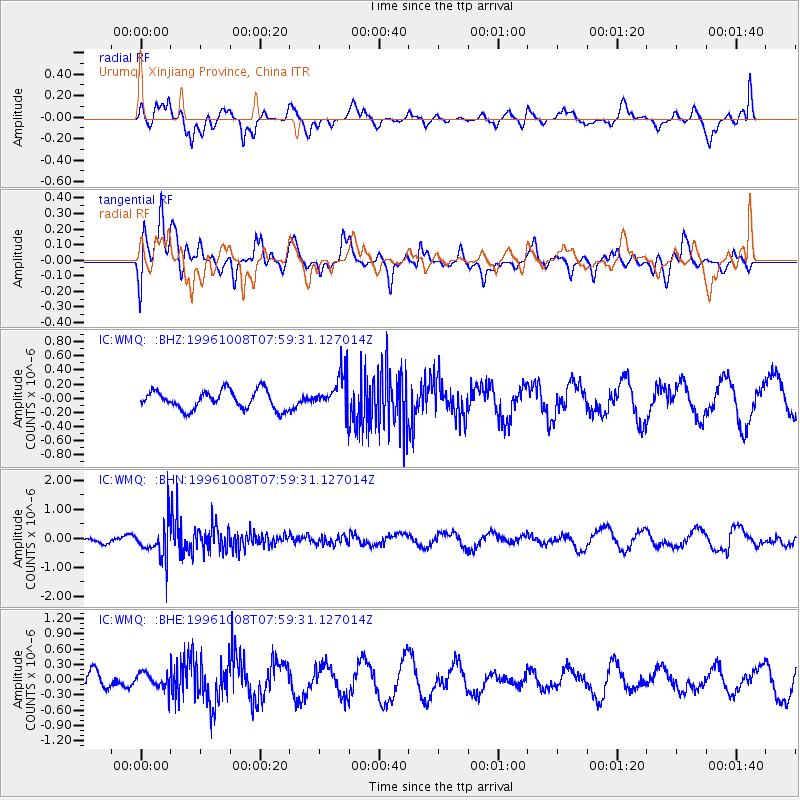
WMQ Urumqi, Xinjiang Province, China - Earthquake Result Viewer
*The percent match for this event was below the threshold and hence no stack was calculated.
| Earthquake location: |
Northwest Of Kuril Islands |
| Earthquake latitude/longitude: |
52.9/152.5 |
| Earthquake time(UTC): |
1996/10/08 (282) 07:52:58 GMT |
| Earthquake Depth: |
627 km |
| Earthquake Magnitude: |
5.6 UNKNOWN, 5.2 MB |
| Earthquake Catalog/Contributor: |
WHDF/NEIC |
|
| Network: |
IC New China Digital Seismograph Network |
| Station: |
WMQ Urumqi, Xinjiang Province, China |
| Lat/Lon: |
43.82 N/87.69 E |
| Elevation: |
903 m |
|
| Distance: |
42.7 deg |
| Az: |
284.831 deg |
| Baz: |
54.051 deg |
| Ray Param: |
$rayparam |
*The percent match for this event was below the threshold and hence was not used in the summary stack. |
|
| Radial Match: |
51.510254 % |
| Radial Bump: |
400 |
| Transverse Match: |
53.574852 % |
| Transverse Bump: |
386 |
| SOD ConfigId: |
4480 |
| Insert Time: |
2010-03-05 00:25:56.860 +0000 |
| GWidth: |
2.5 |
| Max Bumps: |
400 |
| Tol: |
0.001 |
|
Signal To Noise
| Channel | StoN | STA | LTA |
| IC:WMQ: :BHN:19961008T07:59:31.127014Z | 2.8669307 | 6.0346616E-7 | 2.1049205E-7 |
| IC:WMQ: :BHE:19961008T07:59:31.127014Z | 1.0974287 | 1.6407935E-7 | 1.4951254E-7 |
| IC:WMQ: :BHZ:19961008T07:59:31.127014Z | 1.9988903 | 2.6245644E-7 | 1.3130108E-7 |
| Arrivals |
| Ps | |
| PpPs | |
| PsPs/PpSs | |


