You are here: Home > Network List > TA - USArray Transportable Network (new EarthScope stations) Stations List
> Station J26L Joseph Creek, AK, USA > Earthquake Result Viewer
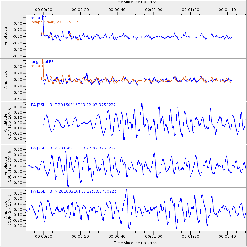
J26L Joseph Creek, AK, USA - Earthquake Result Viewer
*The percent match for this event was below the threshold and hence no stack was calculated.
| Earthquake location: |
Talaud Islands, Indonesia |
| Earthquake latitude/longitude: |
4.7/125.1 |
| Earthquake time(UTC): |
2016/03/16 (076) 13:09:52 GMT |
| Earthquake Depth: |
10 km |
| Earthquake Magnitude: |
5.6 MB |
| Earthquake Catalog/Contributor: |
NEIC PDE/NEIC COMCAT |
|
| Network: |
TA USArray Transportable Network (new EarthScope stations) |
| Station: |
J26L Joseph Creek, AK, USA |
| Lat/Lon: |
64.50 N/143.56 W |
| Elevation: |
1144 m |
|
| Distance: |
86.4 deg |
| Az: |
25.695 deg |
| Baz: |
273.226 deg |
| Ray Param: |
$rayparam |
*The percent match for this event was below the threshold and hence was not used in the summary stack. |
|
| Radial Match: |
78.54064 % |
| Radial Bump: |
376 |
| Transverse Match: |
58.11158 % |
| Transverse Bump: |
335 |
| SOD ConfigId: |
7422571 |
| Insert Time: |
2019-04-22 01:05:16.006 +0000 |
| GWidth: |
2.5 |
| Max Bumps: |
400 |
| Tol: |
0.001 |
|
Signal To Noise
| Channel | StoN | STA | LTA |
| TA:J26L: :BHZ:20160316T13:22:03.375022Z | 2.9647305 | 2.3771562E-7 | 8.018119E-8 |
| TA:J26L: :BHN:20160316T13:22:03.375022Z | 1.8785938 | 1.2451945E-7 | 6.628333E-8 |
| TA:J26L: :BHE:20160316T13:22:03.375022Z | 2.1304028 | 1.5195799E-7 | 7.1328294E-8 |
| Arrivals |
| Ps | |
| PpPs | |
| PsPs/PpSs | |


