You are here: Home > Network List > IC - New China Digital Seismograph Network Stations List
> Station WMQ Urumqi, Xinjiang Province, China > Earthquake Result Viewer
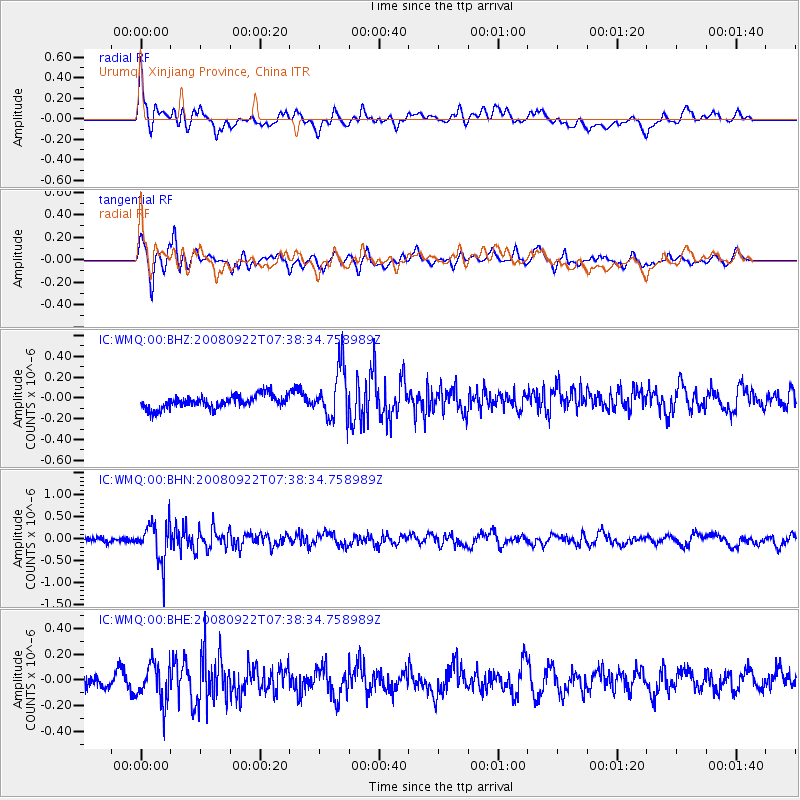
WMQ Urumqi, Xinjiang Province, China - Earthquake Result Viewer
*The percent match for this event was below the threshold and hence no stack was calculated.
| Earthquake location: |
Hokkaido, Japan Region |
| Earthquake latitude/longitude: |
41.6/140.4 |
| Earthquake time(UTC): |
2008/09/22 (266) 07:31:59 GMT |
| Earthquake Depth: |
149 km |
| Earthquake Magnitude: |
5.7 MW, 5.3 MB, 5.6 MW |
| Earthquake Catalog/Contributor: |
WHDF/NEIC |
|
| Network: |
IC New China Digital Seismograph Network |
| Station: |
WMQ Urumqi, Xinjiang Province, China |
| Lat/Lon: |
43.82 N/87.69 E |
| Elevation: |
903 m |
|
| Distance: |
38.3 deg |
| Az: |
291.592 deg |
| Baz: |
74.534 deg |
| Ray Param: |
$rayparam |
*The percent match for this event was below the threshold and hence was not used in the summary stack. |
|
| Radial Match: |
74.17903 % |
| Radial Bump: |
400 |
| Transverse Match: |
71.251724 % |
| Transverse Bump: |
400 |
| SOD ConfigId: |
2560 |
| Insert Time: |
2010-03-05 00:26:15.742 +0000 |
| GWidth: |
2.5 |
| Max Bumps: |
400 |
| Tol: |
0.001 |
|
Signal To Noise
| Channel | StoN | STA | LTA |
| IC:WMQ:00:BHN:20080922T07:38:34.758989Z | 6.5735235 | 4.5588297E-7 | 6.935138E-8 |
| IC:WMQ:00:BHE:20080922T07:38:34.758989Z | 3.1823292 | 1.5084625E-7 | 4.740121E-8 |
| IC:WMQ:00:BHZ:20080922T07:38:34.758989Z | 4.0357814 | 2.5315006E-7 | 6.27264E-8 |
| Arrivals |
| Ps | |
| PpPs | |
| PsPs/PpSs | |


