You are here: Home > Network List > US - United States National Seismic Network Stations List
> Station DGMT Dagmar, Montana, USA > Earthquake Result Viewer
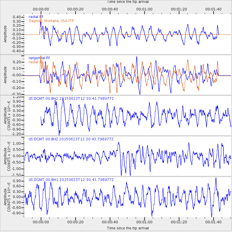
DGMT Dagmar, Montana, USA - Earthquake Result Viewer
*The percent match for this event was below the threshold and hence no stack was calculated.
| Earthquake location: |
Bonin Islands, Japan Region |
| Earthquake latitude/longitude: |
27.7/139.8 |
| Earthquake time(UTC): |
2015/06/23 (174) 12:19:29 GMT |
| Earthquake Depth: |
462 km |
| Earthquake Magnitude: |
5.5 MB |
| Earthquake Catalog/Contributor: |
NEIC PDE/NEIC COMCAT |
|
| Network: |
US United States National Seismic Network |
| Station: |
DGMT Dagmar, Montana, USA |
| Lat/Lon: |
48.47 N/104.20 W |
| Elevation: |
0.0 m |
|
| Distance: |
85.1 deg |
| Az: |
36.887 deg |
| Baz: |
306.902 deg |
| Ray Param: |
$rayparam |
*The percent match for this event was below the threshold and hence was not used in the summary stack. |
|
| Radial Match: |
52.613403 % |
| Radial Bump: |
400 |
| Transverse Match: |
57.65577 % |
| Transverse Bump: |
400 |
| SOD ConfigId: |
1085051 |
| Insert Time: |
2015-07-30 13:50:13.162 +0000 |
| GWidth: |
2.5 |
| Max Bumps: |
400 |
| Tol: |
0.001 |
|
Signal To Noise
| Channel | StoN | STA | LTA |
| US:DGMT:00:BHZ:20150623T12:30:43.798977Z | 1.0213575 | 2.6540152E-7 | 2.5985173E-7 |
| US:DGMT:00:BH1:20150623T12:30:43.798977Z | 2.1718779 | 5.345914E-7 | 2.4614246E-7 |
| US:DGMT:00:BH2:20150623T12:30:43.798977Z | 0.60234 | 3.2266792E-7 | 5.356907E-7 |
| Arrivals |
| Ps | |
| PpPs | |
| PsPs/PpSs | |


