
XAN Xi'an, China - Earthquake Result Viewer
| ||||||||||||||||||
| ||||||||||||||||||
| ||||||||||||||||||
|
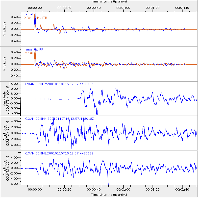
Signal To Noise
| Channel | StoN | STA | LTA |
| IC:XAN:00:BHN:20010110T16:12:57.448018Z | 22.968197 | 1.7578633E-6 | 7.653467E-8 |
| IC:XAN:00:BHE:20010110T16:12:57.448018Z | 18.204659 | 1.3552666E-6 | 7.444614E-8 |
| IC:XAN:00:BHZ:20010110T16:12:57.448018Z | 45.843655 | 5.4235006E-6 | 1.18304285E-7 |
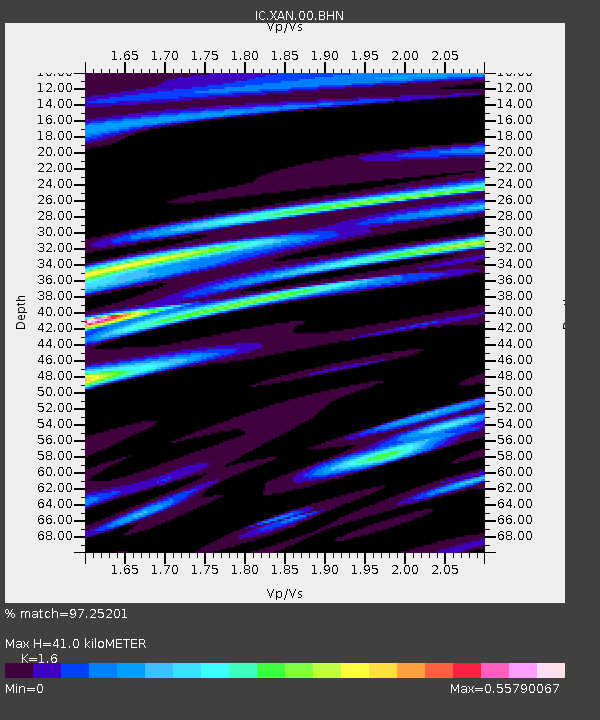
| Arrivals | |
| Ps | 4.1 SECOND |
| PpPs | 16 SECOND |
| PsPs/PpSs | 20 SECOND |

