
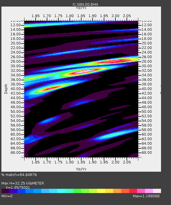
XAN Xi'an, China - Earthquake Result Viewer
| ||||||||||||||||||
| ||||||||||||||||||
| ||||||||||||||||||
|
Signal To Noise
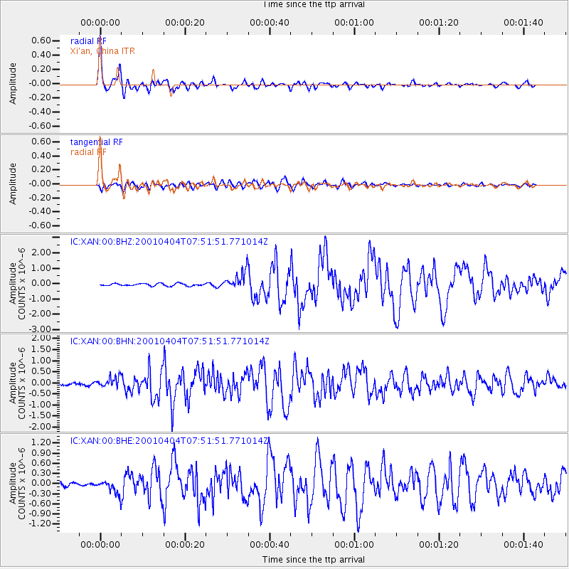
| Channel | StoN | STA | LTA |
| IC:XAN:00:BHN:20010404T07:51:51.771014Z | 4.016145 | 2.4324262E-7 | 6.0566194E-8 |
| IC:XAN:00:BHE:20010404T07:51:51.771014Z | 3.3572965 | 2.1988447E-7 | 6.5494504E-8 |
| IC:XAN:00:BHZ:20010404T07:51:51.771014Z | 8.26102 | 6.298437E-7 | 7.6242856E-8 |
| Arrivals | |
| Ps | 4.6 SECOND |
| PpPs | 14 SECOND |
| PsPs/PpSs | 18 SECOND |

