You are here: Home > Network List > UW - Pacific Northwest Regional Seismic Network Stations List
> Station HOOD Mt Hood Meadows, OR CREST BB SMO > Earthquake Result Viewer
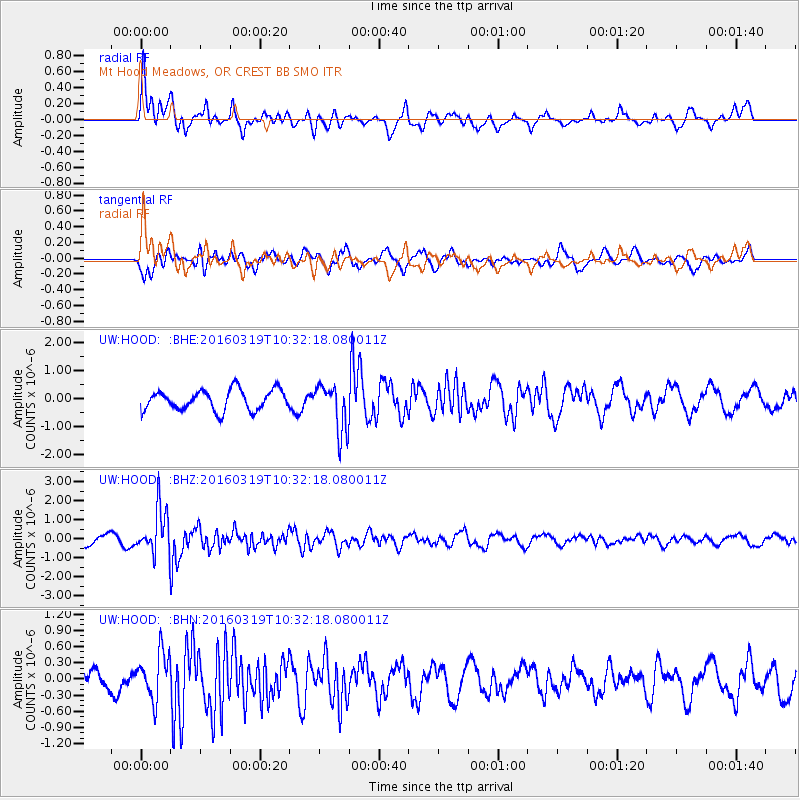
HOOD Mt Hood Meadows, OR CREST BB SMO - Earthquake Result Viewer
*The percent match for this event was below the threshold and hence no stack was calculated.
| Earthquake location: |
Off Coast Of Central America |
| Earthquake latitude/longitude: |
11.9/-88.8 |
| Earthquake time(UTC): |
2016/03/19 (079) 10:24:45 GMT |
| Earthquake Depth: |
10 km |
| Earthquake Magnitude: |
5.6 MWC, 5.6 MWC, 5.6 MWW |
| Earthquake Catalog/Contributor: |
NEIC PDE/NEIC COMCAT |
|
| Network: |
UW Pacific Northwest Regional Seismic Network |
| Station: |
HOOD Mt Hood Meadows, OR CREST BB SMO |
| Lat/Lon: |
45.32 N/121.65 W |
| Elevation: |
1520 m |
|
| Distance: |
43.6 deg |
| Az: |
326.22 deg |
| Baz: |
129.515 deg |
| Ray Param: |
$rayparam |
*The percent match for this event was below the threshold and hence was not used in the summary stack. |
|
| Radial Match: |
63.579197 % |
| Radial Bump: |
400 |
| Transverse Match: |
69.1038 % |
| Transverse Bump: |
400 |
| SOD ConfigId: |
7422571 |
| Insert Time: |
2019-04-22 01:51:01.347 +0000 |
| GWidth: |
2.5 |
| Max Bumps: |
400 |
| Tol: |
0.001 |
|
Signal To Noise
| Channel | StoN | STA | LTA |
| UW:HOOD: :BHZ:20160319T10:32:18.080011Z | 5.1255016 | 1.1839006E-6 | 2.3098238E-7 |
| UW:HOOD: :BHN:20160319T10:32:18.080011Z | 1.8609202 | 4.289919E-7 | 2.3052677E-7 |
| UW:HOOD: :BHE:20160319T10:32:18.080011Z | 2.2945135 | 8.398719E-7 | 3.6603487E-7 |
| Arrivals |
| Ps | |
| PpPs | |
| PsPs/PpSs | |


