You are here: Home > Network List > TA - USArray Transportable Network (new EarthScope stations) Stations List
> Station L04D Klamath Falls, OR, USA > Earthquake Result Viewer
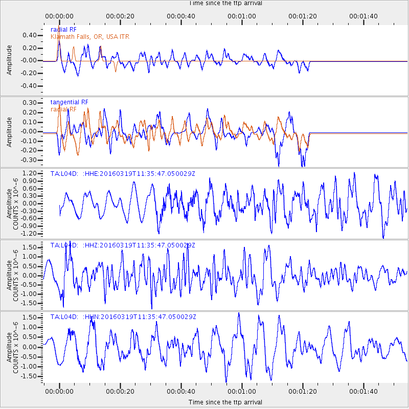
L04D Klamath Falls, OR, USA - Earthquake Result Viewer
*The percent match for this event was below the threshold and hence no stack was calculated.
| Earthquake location: |
Leeward Islands |
| Earthquake latitude/longitude: |
18.0/-60.7 |
| Earthquake time(UTC): |
2016/03/19 (079) 11:26:34 GMT |
| Earthquake Depth: |
32 km |
| Earthquake Magnitude: |
6.0 MWW, 5.9 MWB |
| Earthquake Catalog/Contributor: |
NEIC PDE/NEIC COMCAT |
|
| Network: |
TA USArray Transportable Network (new EarthScope stations) |
| Station: |
L04D Klamath Falls, OR, USA |
| Lat/Lon: |
42.22 N/122.30 W |
| Elevation: |
1437 m |
|
| Distance: |
57.2 deg |
| Az: |
308.975 deg |
| Baz: |
95.116 deg |
| Ray Param: |
$rayparam |
*The percent match for this event was below the threshold and hence was not used in the summary stack. |
|
| Radial Match: |
65.32978 % |
| Radial Bump: |
400 |
| Transverse Match: |
75.40779 % |
| Transverse Bump: |
333 |
| SOD ConfigId: |
7422571 |
| Insert Time: |
2019-04-22 01:59:40.377 +0000 |
| GWidth: |
2.5 |
| Max Bumps: |
400 |
| Tol: |
0.001 |
|
Signal To Noise
| Channel | StoN | STA | LTA |
| TA:L04D: :HHZ:20160319T11:35:47.050029Z | 1.8354445 | 9.316636E-7 | 5.0759564E-7 |
| TA:L04D: :HHN:20160319T11:35:47.050029Z | 1.3202325 | 7.0196364E-7 | 5.3169697E-7 |
| TA:L04D: :HHE:20160319T11:35:47.050029Z | 1.5400988 | 5.7791146E-7 | 3.7524313E-7 |
| Arrivals |
| Ps | |
| PpPs | |
| PsPs/PpSs | |


