You are here: Home > Network List > CI - Caltech Regional Seismic Network Stations List
> Station SMM Simmler, CA, USA > Earthquake Result Viewer
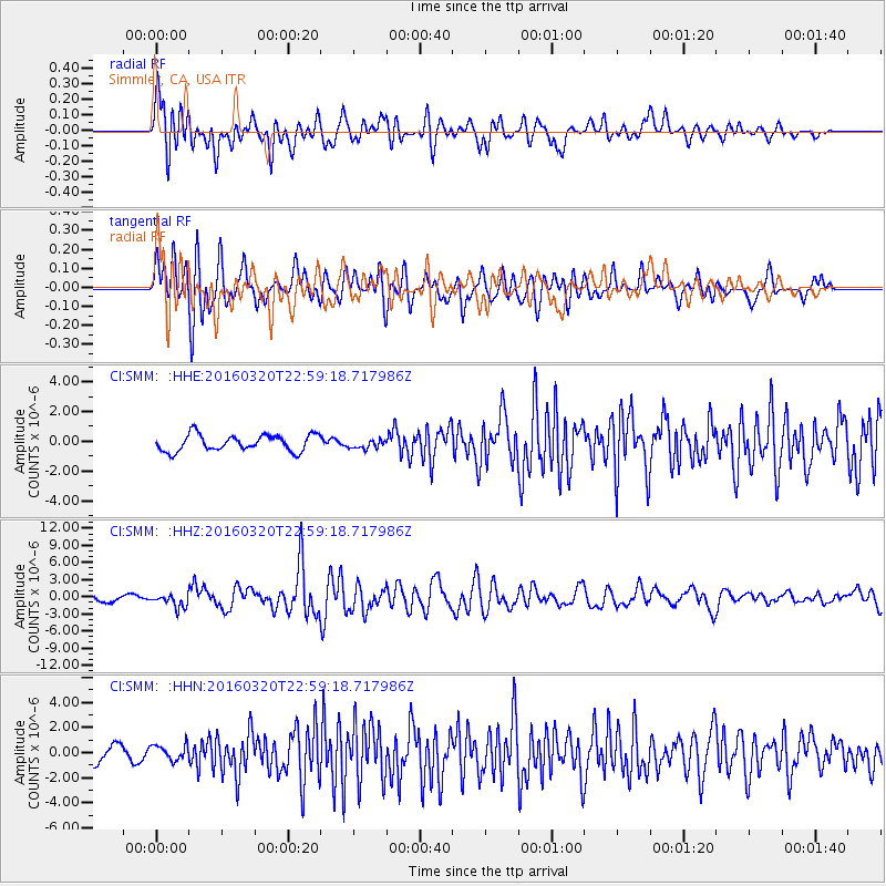
SMM Simmler, CA, USA - Earthquake Result Viewer
*The percent match for this event was below the threshold and hence no stack was calculated.
| Earthquake location: |
Near East Coast Of Kamchatka |
| Earthquake latitude/longitude: |
54.3/162.8 |
| Earthquake time(UTC): |
2016/03/20 (080) 22:50:20 GMT |
| Earthquake Depth: |
31 km |
| Earthquake Magnitude: |
6.4 MWC, 6.2 MWB, 6.6 MI |
| Earthquake Catalog/Contributor: |
NEIC PDE/NEIC COMCAT |
|
| Network: |
CI Caltech Regional Seismic Network |
| Station: |
SMM Simmler, CA, USA |
| Lat/Lon: |
35.31 N/120.00 W |
| Elevation: |
599 m |
|
| Distance: |
55.1 deg |
| Az: |
76.584 deg |
| Baz: |
315.846 deg |
| Ray Param: |
$rayparam |
*The percent match for this event was below the threshold and hence was not used in the summary stack. |
|
| Radial Match: |
81.02941 % |
| Radial Bump: |
400 |
| Transverse Match: |
63.409466 % |
| Transverse Bump: |
400 |
| SOD ConfigId: |
7422571 |
| Insert Time: |
2019-04-22 02:04:38.895 +0000 |
| GWidth: |
2.5 |
| Max Bumps: |
400 |
| Tol: |
0.001 |
|
Signal To Noise
| Channel | StoN | STA | LTA |
| CI:SMM: :HHZ:20160320T22:59:18.717986Z | 2.294201 | 1.2182347E-6 | 5.3100615E-7 |
| CI:SMM: :HHN:20160320T22:59:18.717986Z | 0.8945344 | 6.2078453E-7 | 6.93975E-7 |
| CI:SMM: :HHE:20160320T22:59:18.717986Z | 0.5340668 | 2.9129205E-7 | 5.4542255E-7 |
| Arrivals |
| Ps | |
| PpPs | |
| PsPs/PpSs | |


